Drone Surveying Services for Construction: A Game Changer
Standing on a muddy construction site, blueprints in hand, can be a frustrating experience. You are trying to match the plan to the reality before you, but delays and budget creep are common challenges. Getting accurate data to make critical decisions on construction projects is often a slow and expensive process.
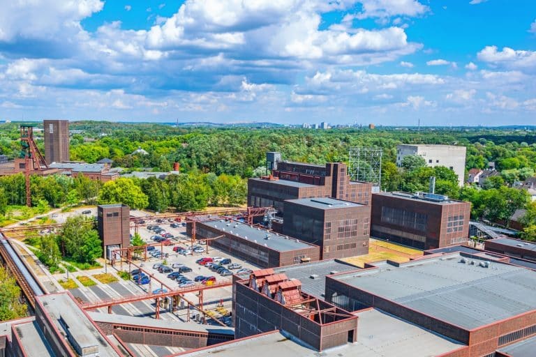
Imagine seeing your entire site from every angle with pinpoint accuracy in a fraction of the time. This is what modern drone surveying services for construction provide and today, we are going to discuss how you can leverage them for your next construction project.
What Exactly is Drone Surveying in Construction?
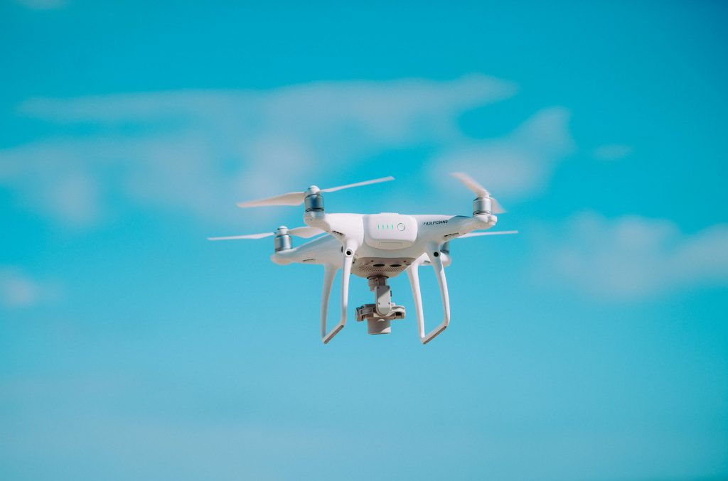
Think of it as the ultimate upgrade to your tape measure and survey wheel. Drone surveying uses advanced drones equipped with high-resolution cameras and sophisticated sensors. The drone technology allows a mapping drone to fly over your construction site in a pre-planned grid pattern.
While in the air, drones capture hundreds or even thousands of overlapping images and data points. This information is then processed with powerful software to create highly detailed and accurate 3D models and maps of your site.
Some projects may use LiDAR sensors, which use laser pulses to measure distances to the Earth, generating a dense point cloud for incredibly precise 3D representations. The National Ocean Service explains this technology is great for mapping terrain, even through vegetation, making it an invaluable tool for modern site assessment.
Old School vs. New School: Traditional Surveying vs. Drones
You might be wondering how this really stacks up against the conventional methods involving a team on the ground. The difference is pretty dramatic. Traditional land surveying methods have served the industry for decades, but they have serious limitations in today’s fast-paced environment.
Traditional land surveyors face physical risks and data constraints that are largely eliminated with drone technology. While a ground crew might take days or even weeks to survey a large site, a drone can often complete the same task in a few hours, saving time and money. This isn’t just about speed; it’s about the depth and usefulness of the aerial data you get back, helping put the entire project into perspective.
This efficiency allows surveying companies to offer more responsive and detailed mapping services. It changes the entire approach to data collection. Let’s look at a direct comparison.
| Feature | Traditional Surveying | Drone Surveying |
| Speed | Slow; can take days or weeks for a large site. | Fast; a 100-acre site can be surveyed in hours. |
| Safety | Higher risk; surveyors walk active sites with heavy equipment. | Very safe; the operator stays in a safe location while the drone flies. |
| Data Density | Captures individual points; thousands of points at most. | Captures millions of data points, creating a complete digital picture. |
| Cost | High labor costs and equipment mobilization fees. | Often more affordable due to less time on site and smaller crews. |
| Accessibility | Limited by terrain; struggles with steep slopes or hazardous areas. | Can access nearly any part of a site, including unsafe or difficult-to-reach areas. |
| Frequency | Costly and time-consuming, so it’s done infrequently. | Can be done weekly or even daily for continuous progress monitoring. |
The Real-World Benefits of Using Drones on Your Job Site
Seeing the comparison is one thing, but how does this technology actually help you manage your project better? The benefits go way beyond just a cool 3D map. They directly address some of the biggest headaches that a project manager faces in construction.
Let’s break down the advantages you can expect.
Improved Job Site Safety
Construction sites are inherently dangerous places. Reducing the time spent walking across uneven terrain, near heavy machinery, or on unstable stockpiles is a significant safety improvement. A drone pilot can stand in a safe spot and capture data from the entire site, minimizing human exposure to risk.
For example, a complete roof inspection can be done without anyone setting foot on the structure. According to federal statistics from the BLS, construction consistently has one of the highest rates of workplace injuries, and drones help bring that number down by keeping your team out of harm’s way.
Faster and More Frequent Data
Speed is everything in construction. The ability to survey your entire site in a morning instead of a week means you can make decisions based on real-time data, not outdated reports. Need to check if the site has been graded correctly before the concrete trucks arrive?
This rapid data collection allows for more effective site management. You can measure your aggregate stockpiles for the month-end report with a quick flight. This speed allows for frequent surveys, so you can access data that provides an up-to-date view of your project, not one that’s already weeks old.
More Accurate Data for Better Decisions
Human error is a factor in any manual process. Traditional surveying relies on capturing points one by one. If you miss a few spots or miscalculate a reading, your map is incomplete or inaccurate.
The drone data collection process is much more thorough. Drones capture millions of data points, creating a comprehensive and highly accurate digital twin of your site.
This detailed information, often gathered through advanced laser scanning or photogrammetry, allows for precise earthwork calculations, better resource planning, and clash detection between designs and the as-built reality.
Serious Cost Savings

Rework is a budget killer in the construction industry. A report from FMI found that poor data and miscommunication account for billions in rework costs each year across the industry.
When you have more accurate data from the start, you can avoid costly mistakes that require you to tear up work and do it again.
The sheer speed of drone surveys also means fewer labor hours are billed to the project. Saving time on surveys translates directly to saving money on the bottom line.
How Drone Surveying Services for Construction Work From Start to Finish
Bringing a drone surveying team to your site is a straightforward process. You do not need to be a technology expert to use these services. A professional drone services company will handle all the technical details for you, ensuring a smooth experience.
The whole process is structured to be as non-disruptive as possible to your daily operations. It is broken down into three simple phases.
Phase 1: Planning and Pre-flight
The process starts with a conversation about your project’s goals. Do you need a topographic map for initial site planning or a volumetric analysis of stockpiles? The survey provider will use this information to create a detailed flight plan.
This plan addresses the specific challenges of your location, whether it is a remote rural area or a busy major metropolitan city. They will check airspace regulations, weather conditions, and any potential site-specific hazards.
For more accuracy, they may set up Ground Control Points (GCPs), which are known points on the ground that the drone data can be tied to for georeferencing.
Phase 2: The On-Site Flight
On the scheduled day, a certified pilot arrives on site. A professional company will always deploy FAA-certified pilots for any commercial operation. They will perform final safety checks before launching the drone, adhering to stringent safety measures.
The drone will then fly the pre-programmed route automatically, capturing the needed aerial imaging and data. This data acquisition is typically very fast and causes little to no disruption to your daily operations. Your crews can often continue their work without interruption while the drone is in the air.
Phase 3: Data Processing and Delivery
This is where the raw aerial data is transformed into actionable intelligence. The data from the drone is uploaded to specialized software. This software stitches all the images together and processes the data points to build the final maps and models.
Within a few days, you’ll receive your deliverables. These can come in many forms, like 2D orthomosaic maps, 3D point clouds, digital surface models (DSM), or detailed PDF reports. Most importantly, this data can be easily imported into the design and engineering software your team already uses for seamless integration.
Applications of Drone Data in Your Construction Project
So you have this incredibly rich data. What can you actually do with it? The applications are almost endless and touch every phase of a construction project, from initial land development to final handover.
Let’s look at some key uses.
Topographic Mapping
Before breaking ground, you can get a detailed map of the land’s contours. This high-resolution drone mapping helps with site layout, drainage planning, and overall design. It provides a foundational layer of information for all subsequent phases of land development.
Earthwork Calculations
Drone data makes calculating cut and fill volumes incredibly accurate. You can track exactly how much dirt is being moved, making sure you stay on schedule and on budget. This is vital for large-scale grading operations on major construction projects.
Stockpile Volume Measurement
Say goodbye to guessing stockpile sizes or relying on less accurate manual measurements. Drones can calculate the volume of sand, gravel, and other aggregates with amazing precision. This is great for inventory management, supplier verification, and financial reporting.
Progress Monitoring
Monitoring construction has never been easier or more visual. Fly the site every week and overlay the new data on top of the old. This gives you a clear, visual report of progress and helps you hold subcontractors accountable for their timelines.
As-Built vs. As-Designed Analysis
You can compare the reality on the ground (as-built) with your original CAD or BIM plans (as-designed). This analysis, often called variance reporting, helps you spot any deviations early. Catching these issues right away prevents them from becoming major problems later on.
Environmental Monitoring and Inspections

Drones are also powerful tools for environmental monitoring on and around construction sites. They can be used to assess erosion control measures, monitor vegetation health, and inspect hard-to-reach areas for compliance. This is especially useful for projects near sensitive ecosystems.
Specialized inspections for structures like a wind turbine are also possible. Furthermore, thermal imaging sensors can be used to conduct a detailed roof inspection, detecting moisture intrusion or heat loss that is invisible to the naked eye. This kind of advanced aerial photography adds another layer of quality control.
Choosing the Right Drone Surveying Partner in the Northeast
Not all drone operators are the same, especially when it comes to high-stakes construction surveying. You’re working with projects worth millions, so you need a partner who is professional, reliable, and properly certified. A flashy website doesn’t guarantee quality data.
What should you look for? Here are a few key things to ask about before you hire someone. Taking a few moments to vet your provider will pay dividends for the duration of your project.
First, always confirm that they deploy FAA-certified pilots. The Federal Aviation Administration requires commercial drone pilots to have a Part 107 certificate. This is non-negotiable and proves they understand the rules of flying safely and legally.
Next, ask about their experience specifically in construction and surveying. A photographer who flies a drone for real estate is not the same as a survey-grade mapping professional. Ask to see examples of their work and the types of data they deliver to other construction clients.
Finally, confirm that they follow stringent safety measures and have sufficient liability insurance. A professional company will have a detailed safety protocol and will not hesitate to provide proof of their insurance. You should also check for a clear privacy policy regarding how they handle your project data and an easily accessible phone number for communication.
The range of services drone services offer can also be a deciding factor. Some surveying companies specialize only in aerial photography, while others provide a full spectrum of data analysis, from laser scanning to thermal imaging.
A good partner will be able to clearly articulate what they can do for you and state that when a project takes shape, they are ready to support it. They may also have experience working with government agencies on infrastructure projects or even assisting in rescue operations by providing rapid site mapping after an incident.
Conclusion
The construction industry is tough, and you need every advantage you can get. Staying on schedule and within budget often comes down to the quality of the information you have.
Relying on old, slow, and sometimes inaccurate methods is a risk that modern projects cannot afford to take.
Drones cover ground faster and capture high-resolution data that leads to better decision-making. The ability to monitor construction closely improves accountability and workflow.
From improving safety to cutting costs and giving you an unmatched view of your project’s progress, this technology gives you the control you need.