Enhancing Projects with Aerial Site Mapping for Developers
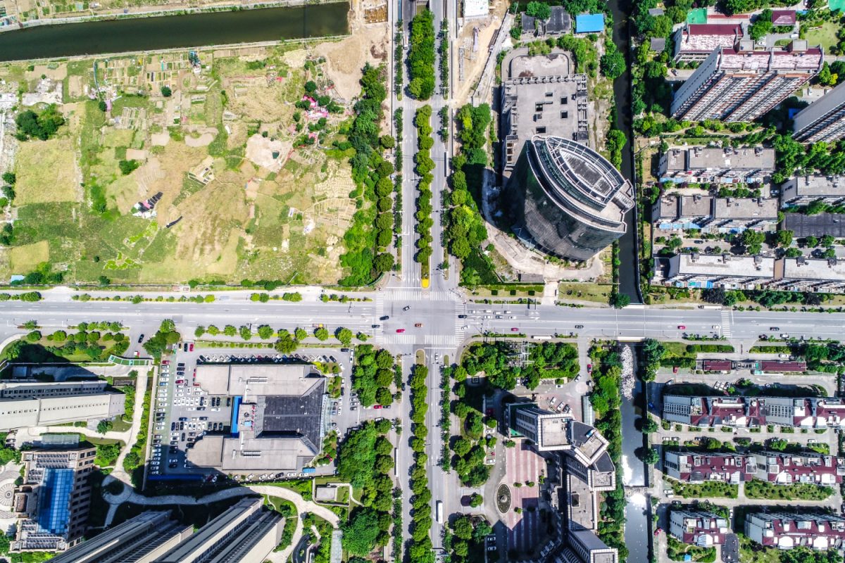
What if you could look down at your entire building project from above? Aerial maps let developers see every little thing about their land. Picture this: you’re hovering over your whole job site.
You see everything down below with perfect clarity. This incredible tool changes everything. Professionals will see a new way to plan, design, and run their projects. Teams quickly catch problems and opportunities coming their way. Getting this squared away long before work even begins clears the path.
Anyone in construction needs to know how to work with drones, utilize good data, and implement strong programs. Aerial site mapping does so much! We’ll look at its many uses and why everyone needs it now.
Curious about how Aerial site mapping happens?
The journey from a drone flight to a detailed site model involves a systematic process. Think about it: every single move we make here really counts. We need to deliver data that’s both accurate and genuinely supports your development team in completing their tasks. Picture this whole project unfolding in four clear stages.
1. Flight Planning
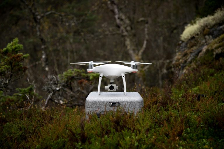
Before a drone even takes off, a detailed flight plan must be created. It simplifies getting all your mission’s pieces in order. Drone pilots just program the drone’s route. They also check the local regulations, weather, and temporary restrictions. Once everything is in order, they initiate the mission. The then flies itself, ensuring it scans every part of the location. Key parameters such as altitude, flight speed, and image overlap are defined to guarantee the quality of the data captured.
2. Data Collection
With a flight plan in place, the drone executes its mission, capturing hundreds or even thousands of geotagged photos. For even greater detail, some drones utilize LiDAR (Light Detection and Ranging) to collect millions of data points, creating an extremely precise point cloud of the terrain and existing structures.
During this stage, ground control points (GCPs) may be placed across the site. For a truly exact final map, we rely on specific marked spots. Each one has a precise, known location that makes the whole picture much more accurate. This ensures the model lines up perfectly with real-world coordinates.
3. Data Processing
Once the flight is complete, the collected raw data is uploaded to a powerful drone mapping software platform. This program takes the overlapping pictures, studying them with photogrammetry to see how they fit, then stitches the photos together, corrects for distortions, and generates the final products. Here, ordinary photos truly find their voice, allowing developers to understand places better through data.
4. Analysis and Reporting

Now, you get to examine all that prepared information. This is where we pull out the really useful ideas.
Teams can perform accurate property measurements, calculate stockpile volumes, and overlay design files onto the map to check for accuracy.
You’ll get clear reports and helpful visuals that everyone on the project team can easily look at and discuss. This ensures everyone, from investors to contractors, is on the same page.
Using Aerial Site Mapping for Developers Gives Land Planners a Real Advantage.
Aerial site mapping gives you more than just great photos. It acts as a smart partner, bringing real advantages to your entire building plan.
Improved Planning and Design
With precise 3D models, developers can visualize a project in its real-world context before construction begins. You can see exactly how a proposed structure will interact with the surrounding landscape or identify potential grading and drainage challenges early. Getting ready for tomorrow means carefully planning our future infrastructure, including roads, power grids, and water pipes, today.
Cost Savings
The financial benefits of aerial mapping are substantial. Those human survey crews are slow and pricey. With drones, you work faster with less people. Catching design problems or site issues with digital scans means no costly do-overs. You save precious time and materials that way.
Increased Safety
Using drones to survey hazardous or inaccessible areas keeps human workers out of harm’s way. Got a steep hill, a wobbly building, or a site with environmental dangers to check? This comes in super handy.
Better Communication

Complex site plans can be difficult to interpret from 2D drawings alone. Imagine showcasing every aspect of your project with interactive 3D models and crisp, high-definition maps. This makes explaining things to clients, investors, and official groups incredibly straightforward.
Faster Project Timelines
The speed of aerial mapping is a significant advantage. A drone can survey a large site in a matter of hours, providing teams with the latest imagery and data by the next day. When we get things done fast, you can make decisions right away. This keeps every project perfectly on schedule, from start to finish.
Choosing the Right Aerial Imaging Technology
While drones are incredibly versatile, they are part of a larger ecosystem of aerial imaging technologies. Depending on the scale and requirements of your project, other options like manned aircraft or even satellite imagery might be considered. You’ll pick the perfect fit for your project once you see what each option does best and where it struggles.
| Technology | Best For | Resolution | Cost |
|---|---|---|---|
| Drones | Small to medium-sized sites (1-500 acres), frequent monitoring, high detail requirements. | Very High (sub-inch per pixel) | Low to Medium |
| Manned Aircraft | Large-scale projects (city or county-wide), regional planning, corridor mapping. | High (2-6 inches per pixel) | High |
| Satellite Imagery | Very large areas (regional or global), historical analysis, areas with flight restrictions. | Low to Medium (12+ inches per pixel) | Varies (can be low for historical data) |
Types of Data from Aerial Site Mapping
The aerial imagery captured during a flight is just the beginning. Different types of data can be drawn from it.
Orthomosaic Maps
An orthomosaic is a single, high-resolution, map-accurate image of the entire site. Unlike a standard aerial photo, it has been geometrically corrected to remove distortions, so it can be used for true-to-scale measurements. This is often the foundational layer upon which other data is built.
Digital Elevation Models (DEMs) and Digital Surface Models (DSMs)
These models represent the site’s topography. A DEM shows the elevation of the bare earth, while a DSM includes the height of buildings, trees, and other features. With these, you can easily see how water drains, lay out any digging, and count up how much dirt to remove or add.
3D Point Clouds and Models
A point cloud is a massive collection of individual points that represent the 3D shape of the site and its objects. Imagine taking raw measurements and shaping them into true-to-life 3D forms. You’ll use these models to gain a clear understanding of everything and examine every last bit of information.
Volumetric Calculations

One of the most valuable features for construction is the ability to calculate volumes with precision. By comparing surfaces from different dates, software can accurately measure the volume of stockpiles or the amount of earth moved. It’s crucial to manage your supplies effectively and double-check what contractors deliver.
How to Get Started with Aerial Site Mapping
Adopting aerial mapping for your development projects is a straightforward process. Just follow the following steps.
1. Choose a Provider or Platform
You can either hire service providers who offer full-service drone mapping or use a platform to manage your own drone program. You need a trusted business, one with a solid past of similar jobs, professionalism, regulatory compliance, and good communication.
2. Define Your Requirements
Clearly articulate what you want to achieve. Do you need a one-time map for initial planning, or ongoing flights to monitor progress? Be specific about the level of accuracy and the types of data outputs you need to get the most value, whether that requires custom solutions or standard packages.
3. Plan the Survey
Collaborate with your provider to plan the initial survey. We first map out the job, identify any local hurdles, and then schedule the flight. If you have specific needs or questions, now is the time to share to ensure everything is covered.
4. Review and Integrate the Data

Once you receive the processed data, review it with your team. Get your data reviewed quickly and share it with your colleagues using helpful services like DroneDeploy’s aerial mapping and processing software. You can also integrate the outputs to CAD, GIS, BIM, or any other platform you are working with.
Real-World Applications
Picture this: this technology is revolutionizing how we build things in numerous areas, including:
Urban Real Estate Development
A real estate developer in a dense urban area uses drone mapping to create a detailed 3D model of their project site and the surrounding neighborhood. What a help this model turned out to be! We used it to figure out shadow paths, sort out tight-space plans, and create marketing materials that really sell themselves.
Renewable Energy and Infrastructure
For a large-scale solar farm project, aerial mapping can be used to conduct the initial topographic survey and optimize the placement of thousands of panels or conduct routine inspections on power lines and cell towers.
Post-Event Disaster Response
Following a major storm, a development company can use drones for rapid disaster response, assessing damage to their properties without putting inspectors in harm’s way. This allows them to begin recovery much faster than with traditional methods.
Commercial Asset Management
The owner of a large portfolio of commercial properties can use drones for routine asset management. Regular flights over their shopping centers and industrial parks allow them to create up-to-date inspection reports on roof conditions, parking lot integrity, and landscaping. Acting early truly benefits them. Follow your things, making sure they’re all accounted for.
Conclusion
Aerial site mapping completely upgrades how developers handle every part of a project. Imagine pinpoint precision every single time.
That means a safer operation for everyone and serious cuts to your budget and work hours. From initial planning with high-resolution aerial maps to long-term asset management, the benefits are undeniable.
Whether your focus is real estate, renewable energy, or large-scale infrastructure planning, embracing drone mapping is a strategic move.


