Exploring Drone Thermography for Commercial Infrastructure
Your building has a story to tell, but it’s not speaking in words. It’s talking in temperature. Heat spots can point to trouble. Things like unseen water damage, bad insulation, or risky wiring all leave their mark.
The issue is that you cannot see these anomalies with the naked eye. This is where using drone thermography for commercial infrastructure gives you an incredible advantage. You can spot things you normally wouldn’t see, stopping small snags before they turn into huge, costly messes.
Think of it as giving your property a health checkup from the air. Imagine seeing everything: the activity underground, the scenes on the roof, and even what’s going on behind the walls. Using advanced drone thermography for commercial infrastructure is about proactive management, not reactive repairs; it is about protecting your investment with better data.
What Exactly Is Drone Thermography?
The concept is straightforward. You can actually see and measure heat, thanks to thermography. Special imaging systems, such as an infrared camera or thermal imaging camera, detect temperature differences on surfaces.
Regular cameras see only visible light, but these devices pick up different kinds of light. Instead, a thermal sensor measures the invisible infrared radiation that all objects emit. The camera then takes that heat energy and paints a picture. It shows you the warmer spots glowing in colors distinct from the cooler areas.
A drone simply takes this powerful imaging camera to the sky. This gives us a bird’s-eye view that was once impossible to get safely or affordably. Now, with modern drone technology, we can scan huge rooftops, tall facades, and large construction sites in minutes, not days.
Understanding the Technology Behind Thermal Drones
At the core of these systems is a sophisticated thermal sensor. Picture a tiny sensor that feels the warmth from *every* object, as long as it’s not totally frozen. That’s this part’s job. This sensor immediately converts incoming infrared radiation into an electrical output.
The raw information then becomes a thermogram, essentially a heat picture showing how hot or cold spots are. The quality of this image depends heavily on the camera’s resolution; a high resolution camera can detect smaller temperature differences from farther away. Getting solid temperature numbers during any check-up really makes a difference.
Many professional drones are equipped with hybrid thermal payloads. These sophisticated imaging setups integrate a specialized thermal sensor with a conventional optical camera. Imagine seeing both the heat signature and the visible view simultaneously. That helps you truly understand what’s causing any odd readings.
Why Drones Are a Game Changer for Thermal Inspections
How did we check for issues before imaging drones? The old way was slow, expensive, and often dangerous. Inspectors strapped on thermal cameras, climbed ladders, set up scaffolds, or even rappelled down walls.
Using handheld thermal devices often puts staff in harm’s way and messes with daily work. Getting a full picture of a large commercial roof might take a full crew several days of spot checks. High expenses and potential legal risks really troubled asset managers and construction supervisors.
Thermal drones change all of that. A single operator can launch a drone and gather more comprehensive thermal data in a fraction of the time. Drone inspections keep people out of harm’s way, get the job done quickly, and save a good amount of money.
| Feature | Traditional Methods | Drone Thermography |
|---|---|---|
| Safety | High risk for workers at heights | Operator remains safely on the ground |
| Speed | Days or weeks for large assets | Hours for the same assets |
| Cost | High labor and equipment costs | Significantly lower operational costs |
| Data Quality | Spot checks, can miss issues | Comprehensive, full-coverage thermographic data |
| Disruption | Major disruption to site operations | Minimal to no disruption |
Drone Thermography for Commercial Infrastructure: Practical uses.
Imagine all the places this technology could help; it fits so many industries. From a new high-rise going up in New York City to an agricultural operation in Pennsylvania, the benefits are clear. We simply need solid facts to choose well.
This is not just about finding problems. We also check that the job was done correctly and the materials used hold up as expected. Let’s look at how specific industries are putting drone thermal imaging to work.
For Commercial Building Management
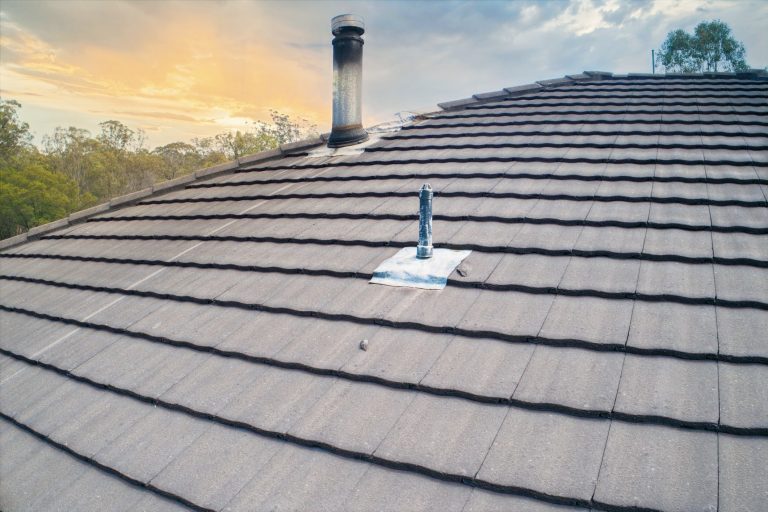
For facility managers, the biggest enemy is often water. A small leak in a flat commercial roof can go undetected for months. By the time you see a stain on a ceiling tile, the damage to insulation and decking is already severe and widespread.
A drone with a thermal camera can perform roof inspections just after sunset. As the roof cools, trapped moisture in the insulation retains heat longer. These warmer areas show up brightly in the thermal imagery, pointing directly to potential leaks needing repair.
That same rule covers the entire exterior of a building, including walls made of concrete. Thermal imaging can show exactly where heat is escaping in the winter or where cool air is leaking out in the summer. Picture this: lower energy bills and a much cozier home. That’s what happens when you pinpoint exactly where to seal and insulate.
For Construction Projects
On an active construction site, quality control is everything. Forget breaking down walls. Drones with thermal cameras let project managers confirm work quality without any damage. Thermal analysis lets us spot issues that are invisible to the naked eye. This directly boosts the quality of everything we construct.
For example, you can check that concrete is curing evenly to prevent structural weaknesses. Examine the brick and stone work to identify any missing grout or moisture that may be hiding behind the surface. This helps you address issues during the building process, not after the client moves in.
You’ll want to inspect your HVAC and electrical systems thoroughly before the walls go up and hide them. A thermal drone can spot overheating connections or blocked ducts from a safe distance. Thinking ahead stops expensive last-minute changes and holdups.
For the Energy Sector
The energy industry, especially renewables, has seen huge benefits. A large solar farm can have thousands of individual panels. Finding a single defective panel manually would be an almost impossible task for a maintenance crew.
Imaging drones can fly over an entire solar farm very quickly. Defective cells or panels often run hotter than functioning ones, a pattern easily detected with a thermal imaging drone. You’ll have more power because we can quickly replace and fix specific areas.
Power companies put drones to work, scanning vast stretches of power lines, examining substations, and looking over wind turbines. This keeps our electricity flowing. An overheating transformer or failing insulator on a wind turbine is a clear hazard. We prevent power loss and machinery breakdowns by having a drone identify those tell-tale hot spots from a safe distance.
For Public Safety and Environmental Management

The capabilities of thermal drones extend into public safety and land management. Imagine someone lost in the wilderness; police can send up drones with heat-detecting cameras. These eyes in the sky are crucial for finding them.
A person’s body heat stands out against a cooler background, making it easier to locate someone lost at night or in dense terrain.
On the farm, drones scan fields to check on plants. They also help farmers decide where to send water. Big ranches and nature parks find thermal drones super helpful. They can watch animals or spot a grassland fire starting. This lets us act fast. That way, we protect homes and our natural environment.
How a Thermal Drone Inspection Works
You might be wondering what the actual process looks like. It is more than just flying a drone around. We carefully gather heat readings and turn them into facts you can really use.
The entire operation is managed from a drone control panel on the ground. Pilots use this central screen to keep a close eye on their flight path, tweak camera angles, and instantly see live temperature readings. We follow a strict method so the information you receive is always spot-on and genuinely helpful.
Planning the Flight – The first step is understanding your goal. So, is it water getting in, power slipping away, or solar panels acting up? The flight plan, time of day, and environmental factors are all planned based on the specific mission to gather accurate thermal information.
Gathering the Data – Next, a certified drone pilot executes the flight plan. They fly the drone, such as a DJI Matrice or Autel model, in a predetermined pattern to get full coverage of the area of interest. This flight path ensures no data is missed and that all images overlap properly for processing.
Processing and Analysis – This is the most important part of the inspection. Raw thermal images need to be interpreted by someone who knows what they’re looking for. A trained thermographer uses specialized software to analyze heat images. They identify hot or cold spots and understand the true meaning of those signals.
Getting the Report Ready – All the information then comes together in one clear, detailed report. This is not just a folder of pictures. You’ll find this document straightforward. It highlights problem areas with both thermal and regular photos, giving you a complete picture. Then, it clearly tells you what to do next.
What to Look for in a Drone Service Provider
Piloting a drone is simple enough. But to get quality thermal scans, you need sharp skills and serious equipment. So, you’re figuring out who you want walking beside you? Consider what truly matters, like genuine respect and a connection that feels easy.
First, confirm the pilot holds a current FAA Part 107 certificate. This is the law for any commercial drone operation in the United States. They clearly know the air traffic rules and how to stay safe.
Second, ask about their camera systems. Thermal camera resolution and the quality of their IR cameras matter a lot. A low-resolution camera might miss small but critical issues, so you need a provider with professional-grade gear from manufacturers like Teledyne FLIR.
The provider’s experience interpreting the thermographic data is most important. Do they have certified thermographers on staff who understand thermal analysis? True expertise lies not in taking the picture, but in knowing how to work thermal cameras and what the data means for your building or infrastructure.
Picture a specialist running data through imaging software, searching for insights. They can change the color palette to better highlight issues, perform temperature tracking on specific objects, and set isotherms to isolate particular temperature ranges. With this fine detail, spotting subtle changes in surface temperature becomes very exact.
Conclusion
Ignoring hidden problems in your commercial infrastructure is a risk you do not need to take. Good news: the technology we need to identify these issues is now accessible to everyone. You get to decide how long your home stays healthy.
You’d be amazed by all the important jobs thermal drones can handle. Imagine catching a roof leak early, slashing your energy bills, and knowing your new home is built right.
Smart and proactive management powered by drone thermography for commercial infrastructure is the new standard for protecting your assets.
You can prevent huge repairs from starting by fixing the small stuff right away. This keeps your risks low and your money flowing. You’re investing in what your home will be worth later.