A Guide to Construction Site Drone Mapping and Analysis
Drones are everywhere these days, but you may still wonder how they actually fit into a real job site. Building projects often have tight deadlines and even tighter budgets.
A minor mistake can quickly escalate into significant trouble. This is where modern construction site drone mapping and analysis completely changes the game.
Why Drones Are a Must-Have for Your Next Project
It’s easy to dismiss new tech as another complicated thing to learn. But drone data isn’t just a fancy extra. Here are some reasons to consider it.
Keep Your Project On Time and On Budget
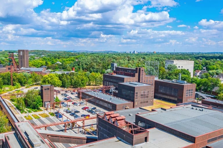
How often do you rely on rough estimates to track progress? Drone mapping delivers incredibly precise measurements right to you. You can see precisely how much earth has been moved each week or check if foundations are being poured according to plan, allowing you to monitor construction progress effectively.
Imagine catching a problem the moment it appears! You can compare your original blueprint with the work in progress, allowing you to correct any missteps immediately.
For example, comparing the as-built drone data to your design files can reveal if a concrete slab was poured at the wrong elevation.
Identifying discrepancies early, such as a misplaced utility line, prevents extensive rework and significant change orders, resulting in real cost savings.
Tracking every step of the project and regularly visiting the site lets you spot spending issues before they grow into big headaches.
According to a report by Autodesk and FMI, bad or inaccurate data cost the construction industry over a $1.85 trillion in 2020, showing the demand for accurate data, such as what you get from drones.
Improve Site Safety for Your Crew
Safety is the top priority on any job site. Drones can inspect hazardous or hard-to-reach areas, such as rooftops, scaffolding, or unstable slopes, without risking an employee’s well-being.
Forget the old way of checking things by hand; this is a game-changer for the Northeast. It’s especially vital when harsh weather sweeps through.
You might want to measure the material piles at a Pennsylvania quarry. Instead of sending someone to climb a potentially shifting pile, a monitoring drone can fly over it in minutes and calculate volumes with fantastic accuracy.
These stockpile measurements can be performed regularly without interrupting heavy machinery operations.
Managers who thoroughly examine the entire site can identify hidden dangers, map out safe paths for their equipment, and ensure everyone follows the safety rules.
Better Communication and Fewer Arguments

Trying to explain a complex issue to an owner or architect over the phone can be a frustrating experience.
A detailed 3D model or an up-to-date map makes communication simple. Everyone, from the foreman to the investor, can view the same visual construction data, which reduces misunderstandings.
If a dispute arises with a subcontractor about work completed, you have a time-stamped visual history. Clear project records enable teams to settle arguments quickly and fairly.
The Process: Your Guide to Construction Site Drone Mapping and Analysis
Getting started with drone mapping is more straightforward than you might think. The entire journey is concise, consisting of just a few key steps. You’ll go from your initial thoughts straight to real, actionable insights.
Step 1: Planning the Mission
This is the foundation for getting good data. An experienced drone pilot will define the project boundaries and plan the drone’s flight path using specialized software. Imagine getting stunning aerial shots where every detail is sharp and perfectly scaled! We fly the drone at the ideal altitude, capturing images with just the right amount of overlap to avoid any lens quirks.
The pilot also handles all the important safety and legal checks. This includes verifying airspace rules with the Federal Aviation Administration (FAA) and checking for any local restrictions. This is especially important in the crowded skies of New York and Massachusetts.
Step 2: Capturing the Data On-Site
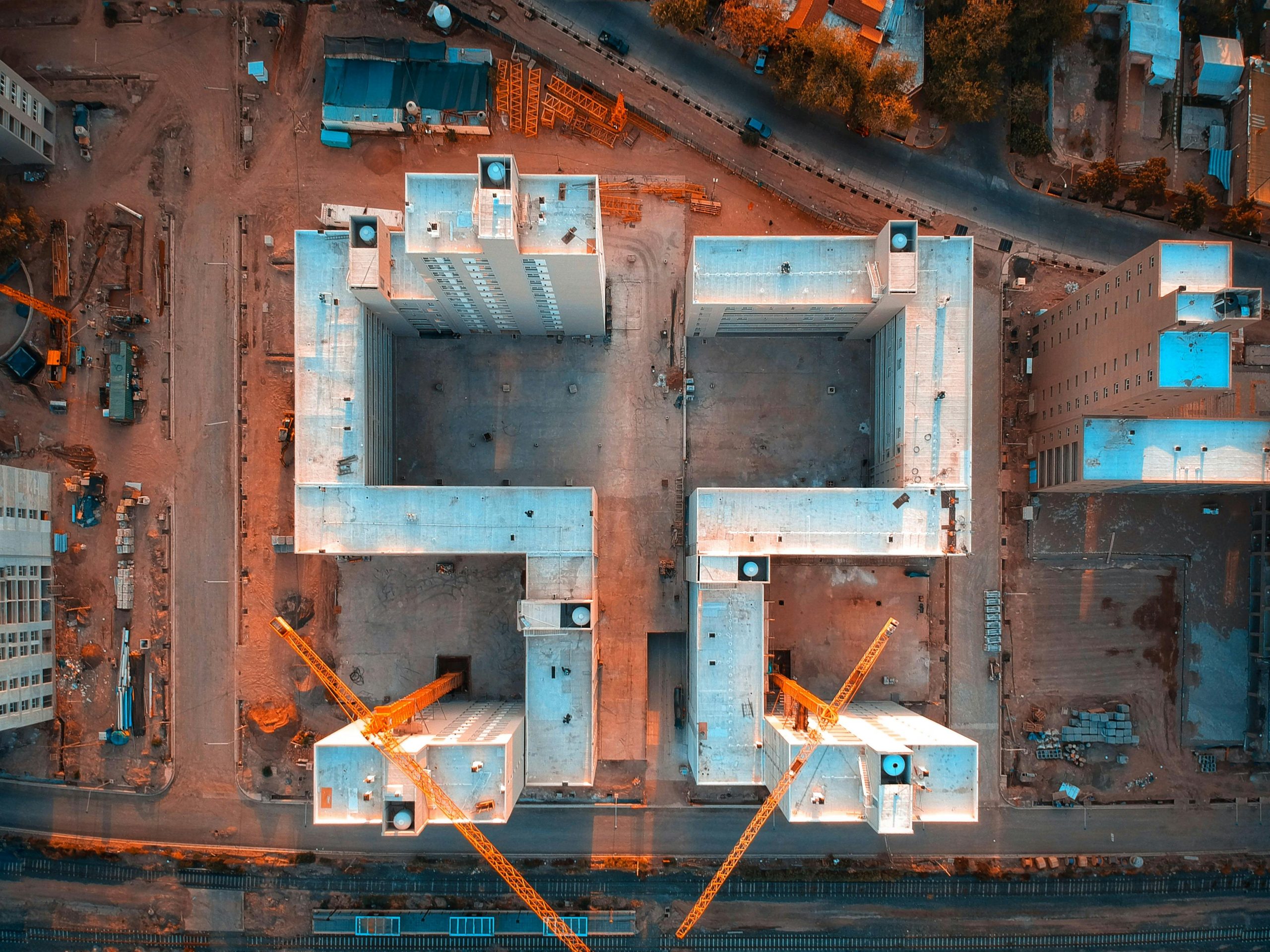
Once the plan is set, the construction drone is launched. It will fly the pre-programmed route autonomously, capturing images with its camera. The whole drone mapping work process is surprisingly fast.
For projects needing the highest level of accuracy, Ground Control Points (GCPs) might be placed on the site. These are marked points on the ground with known GPS coordinates. When you add these, your map lines up perfectly. It gives you amazing precision, spot-on to a centimeter.
Modern drones streamline this process even further with on-board RTK or PPK technology. These systems fix any inaccuracies right away. You get accurate results with far fewer ground markers. This dramatically reduces the on-site documentation time for the survey crew.
Step 3: Processing the Images into Maps and Models
After the flight, the images are uploaded to a cloud-based processing platform or drone mapping software. This is where the real heavy lifting happens. Our mapping tool finds thousands of identical spots in the pictures that overlap. From these spots, it builds a really precise 3D model of the entire place.
From this central model, several different data products are generated. These include the orthomosaic map, 3D models you can view from any angle, and digital surface models that show terrain elevation. This stage typically takes a few hours to a day, depending on the project’s size, and provides a complete, unified reality model.
Step 4: Analyzing the Data for Insights

This is where the value truly shines. With the processed data available on an easy-to-use platform, you can start asking important questions.
You can use digital tools to measure distances, calculate areas, and determine volumes for stockpiles right from your desk, eliminating the need for another site visit.
You can also overlay design files (like CAD drawings) onto the map to instantly see how the as-built site conditions compare to the plan.
You’ll use this map to actively check work quality, track your earth-moving progress against plans, and give solid updates to all project partners.
What Kind of Data Do You Actually Get?
The final deliverables from construction site monitoring are more than just pictures. From the newest team member to the seasoned project manager, everyone taps into these robust data tools for their projects.
| Data Type | What It Is | How You Can Use It |
|---|---|---|
| Orthomosaic Map | A single, high-resolution 2D map of the entire site, corrected for perspective and scale. | Monitor overall site progress, measure distances and areas accurately, and overlay design plans for comparison. |
| 3D Point Cloud | Millions of individual points that together form a 3D shape of the site and everything on it. | Create highly detailed 3D models, import into design software like AutoCAD or Revit, and take complex measurements. |
| Digital Surface Model (DSM) | A 3D map that shows the elevation of every point on the site, including buildings, trees, and equipment. | Analyze site drainage, calculate cut and fill volumes for earthworks, and plan logistics for moving materials. |
| 3D Textured Mesh | A realistic 3D model of the site with photographic textures applied. | Create visually impressive progress updates for clients, perform virtual site walk-throughs, and communicate project status clearly. |
Conclusion
Staying competitive in today’s construction market means working smarter, not just harder. You need gear that really helps you work faster, stay safe, and communicate clearly. Imagine seeing every inch of your project from above.
Our drone mapping services help you eliminate the guesswork and make truly informed decisions based on precise measurements.
By bringing this technology to your construction projects in New York, Massachusetts, or anywhere else in the Northeast, you’re not just adopting a new gadget. You are fundamentally improving your project management workflow.