3D Modeling Drone Services for Contractors
Imagine your construction projects with clearer plans.
Drone 3D modeling gives contractors the visual precision needed to take their work to a new level.
New digital programs are totally changing how building jobs get drawn up, built, and shown off.
Grasping what 3D modeling drones offer quickly reveals just how much they can improve your projects.
We’ll explore why this matters so much for builders and look at exactly how it gets used on job sites.
Consider what you learn here. It might just lead you to add this tech to your building work.
What Are 3D Modeling Drone Services for Contractors?
3D modeling drone services for contractors merge the capabilities of high-quality aerial imagery and orthomosaic mapping with sophisticated software.
Together, these tools build incredibly clear 3D images of building projects or individual pieces of property.
Most of the time, we move through a set of vital actions, bringing in all the relevant information to craft the models.
- Site flyover: An FAA-approved drone operator expertly pilots the UAV over the construction site or job site. While airborne, the drone will snap incredibly detailed photos of the terrain and log crucial information like temperature and altitude with its sensors.
- Data processing: The collected raw data, consisting of hundreds or thousands of images and measurements, is then fed into specialized software. This software employs techniques like modeling – photogrammetry to stitch together the images and create precise 3D models and orthomosaic maps.
- Model delivery: The finalized 3D model, along with any supplementary data analysis, is then delivered to the contractor.
These drone services work effectively at multiple stages of a construction project.
From initial site surveys providing crucial pre-construction insights, to ongoing progress tracking with regular updates, and finally, for creating as-built documentation.
Getting pinpoint accuracy and amazing detail used to be a real challenge with older surveying tools.
Now, these 3D models deliver just that, giving modern builders a serious edge.
Practical Ways Contractors Apply Drone 3D Modeling Services in the Field.
Let’s see how these drone services work with some actual examples.
The many jobs drones perform for today’s building are evident in these examples.
New tech consistently brings forth more and more uses.
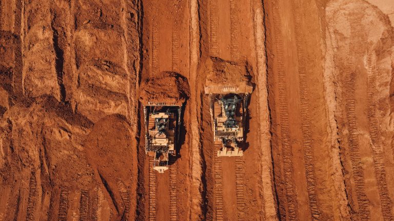
Site Surveys and Aerial Mapping
Before any ground is broken on a new project, contractors can leverage 3D modeling drone services to create highly detailed topographical maps and comprehensive site plans.
It’s how we plan the digging, smooth out the land, and build the water channels.
Precise land checks let you see the ground clearly, so you catch future issues fast.
Building Information Modeling (BIM) Integration
The 3D models generated by drones can be seamlessly integrated into Building Information Modeling (BIM) software.
Imagine having every real-world detail about a construction site built right into your plans.
That lets you create incredibly precise and thorough project blueprints from the first sketch.
It makes working together in BIM easier by giving everyone the most current information.
Volumetric Calculations
For projects involving substantial earthwork, such as excavations, embankments, or material stockpile management, 3D modeling drone services provide remarkably accurate volumetric calculations.
Drones gather visual imagery and elevation data from above.
Sophisticated software then processes these inputs, precisely computing material volumes.
Effectively managing the volume of materials like rebar or drywall directly on a construction location becomes far more straightforward.
Structural and Quality / Integrity Inspections

Drones equipped with high-resolution cameras, and sometimes thermal or LiDAR sensors, can be deployed to conduct detailed structural inspections.
This includes checking a roof for leaks, a building’s outer walls for decay, or a bridge for structural weaknesses.
It’s much safer and simpler to inspect risky or hidden parts of large structures, such as buildings, bridges, and towers, compared to scaffolds or lifts.
Marketing and Client Presentations
The visually stunning 3D models and progress aerials created from drone data can be powerful tools for marketing and client presentations.
Your completed work practically jumps off the screen when you use these models.
Each project becomes a truly compelling part of your portfolio.
Choosing a 3D Modeling Drone Service Provider
If you are convinced of the benefits and interested in utilizing 3D modeling drone services for your contracting business, selecting the right provider is a critical step.
To pick a business you can truly trust, keep these important points in mind.
- Industry experience – This includes a profound grasp of the industry’s inner workings and the specific services we provide.
- Quality of equipment, including drones, sensors (cameras, LiDAR, thermal), and processing software.
- Turnaround time for data processing, analysis, and model delivery.
- Proper licensing (e.g., FAA Part 107 certification) and comprehensive insurance coverage.
- Transparent cost and pricing structure, including options for custom solutions.
- Availability of customer support, training, and consultation on how to best use the data.
- Demonstrated ability to deliver consistent progress aerials and accurate orthomosaic maps.
- Portfolio of previous projects and client testimonials.
It is prudent to request sample projects or detailed case studies to assess the quality of work and the depth of their data analysis capabilities.
Trying out a small test run first can give you a better idea of what works.
You can test how fast a service provider reacts, the quality of their actual output (like a sample report or initial design), and whether their approach blends with your existing workflow.
Legal and Regulatory Considerations
When engaging with 3D modeling drone services, it is crucial to be fully aware of and compliant with all applicable legal and regulatory requirements.
In the United States, commercial drone operations are primarily regulated by the Federal Aviation Administration (FAA).
To run things safely and within the law, sticking to these rules is an absolute must.
Several critical aviation regulations from the FAA deserve your attention:
- Drone operators conducting commercial flights must possess a Part 107 remote pilot certificate issued by the FAA. Ensure that any provider is FAA-approved.
- Drones weighing more than 0.55 pounds (250 grams) must be registered with the FAA.
- There are strict airspace restrictions, prohibiting flights in certain zones such as near airports, over large gatherings of people, or in restricted government airspace without specific authorizations.
- Local, county, and state regulations may also apply to drone operations, so it is vital to research and comply with the specific rules in your operational area.
Confirm that any drone service provider you collaborate with is fully compliant with all pertinent FAA regulations and local laws.
Getting things right from the start prevents legal trouble and expensive fines.
Think about it: this helps secure your job sites and keeps the surrounding neighborhood safe from any issues.
The Future of 3D Modeling Drone Services for Contractors

Drone technology and its software are moving ahead quickly.
Expect to see 3D drone models used in construction in even more innovative, more effective ways.
Anticipate these forthcoming improvements:
- Powerful artificial intelligence and machine learning are stepping up. They automatically analyze our work areas, spot oddities instantly, and give us a heads-up on what’s coming.
- Get instant 3D models from drone surveys. You see the results live, letting you make quick decisions while still out in the field.
- You’ll find much smaller, sharper sensors gathering all sorts of detailed info. This means crisp thermal images, special hyperspectral views, and even simpler LiDAR to create super accurate 3D models.
- Greater interoperability and seamless integration with other construction technologies, such as augmented reality (AR) for on-site visualization, virtual reality (VR) for immersive project reviews, and robotics for automated tasks informed by drone data.
- Expect powerful new analysis tools that chew through huge amounts of information, helping you discover deeper patterns.
Conclusion
Picture your next project with fewer mistakes and quicker progress.
3D drone modeling helps contractors get super accurate data, move faster, and communicate clearly across all job phases.
If your contracting business has not yet explored this technology, now is an opportune moment to consider how 3D modeling drone services could revolutionize your operations.