Drone Surveying for Land Development New York: A Guide
You’re staring at a raw piece of land in New York and envision the potential, the future building, the successful project. But between you and that vision stands a mountain of prep work, starting with a land survey. The old way meant weeks of waiting and a huge bill, holding up your entire real estate project.
That’s why smart developers are now trying a different approach – drone surveying land development in New York. This approach offers an entirely different perspective on your property. With this method, you get more information faster than ever before.
This allows you to make smarter decisions from day one. Good choices at the start are crucial for any project’s success, making drone surveying for land development in New York a strategic move.
What Is Drone Surveying? (And Why Should You Care?)
So, what’s all the buzz about? Think of it this way. For decades, land surveying involved crews walking a site with tripods and equipment. They would take measurements one point at a time, a process that is both slow and expensive.
This traditional method is effective, but it only provides a sparse snapshot of the land. Drone surveys flip that script entirely. We use a high-tech surveying drone equipped with a specialized camera or sensor to conduct an aerial survey.
The drone flies a pre-planned grid pattern over your property, capturing hundreds or even thousands of high-resolution aerial images from different angles. This aerial data is then processed with powerful photogrammetry software. The software stitches the images together to create a super-detailed, measurable 3D model of your entire site, letting you see every feature with incredible clarity.
The Tech Behind the Flight: A Peek Under the Hood
You don’t need to be a tech wizard to see the benefits. But knowing a little about what’s happening helps you understand the power of the surveying solutions you’re getting. The UAV technology behind modern aerial mapping is quite amazing.
Photogrammetry: Creating 3D Maps from Photos
The most common method is called aerial photogrammetry. The idea is simple: by taking many overlapping photos from the air, software can identify common points in the images. This process lets the program calculate depth and create accurate photogrammetry models of the terrain.
The result is a rich, color 3D model and a high-resolution map of your property. From these photogrammetry models, you can measure distances, areas, and volumes right from your computer screen. This level of site documentation is an incredibly powerful tool for planning and design.
LiDAR: Seeing Through the Trees
What if your New York property is covered in trees? That’s where LiDAR comes in. LiDAR, which stands for Light Detection and Ranging, uses laser scanning to map the ground.
A drone-mounted LiDAR system sends out thousands of tiny laser pulses per second that bounce off surfaces and return to the sensor. Some laser pulses hit the top of the tree canopy. But others sneak through the leaves and branches to hit the actual ground, allowing us to map the ‘bare earth’ topography.
This is a big deal for wooded sites or projects requiring environmental monitoring. Drone-mounted lidar systems create detailed topographic maps even through dense vegetation. The resulting terrain models are essential for accurate site assessments and planning.
RTK and PPK: Getting Pinpoint Accuracy

You might hear the terms RTK or PPK, which are advanced GPS technologies. You don’t need to get bogged down in the technical details. Just know they are essential for professional survey services.
These systems correct for the tiny errors inherent in all GPS signals by using a stationary ground base station that communicates with the drone. The result is data that achieves centimeter-level accuracy. A high-accuracy drone with this technology can provide highly accurate data for serious land development projects.
Big Benefits of Drone Surveying for Land Development in New York Projects
So, what does this all mean for your bottom line?
Get Your Data in Days, Not Weeks. Traditional land surveys can take weeks to complete, especially for large areas. A drone can often capture all the data for a 100-acre site in a single afternoon, allowing you to move to planning and approvals much faster.
Lower Your Project Costs. Time is money, but so is labor. Drone surveys need a smaller crew on-site for a much shorter period, directly lowering your costs. Better data upfront also helps you avoid expensive surprises and redesigns down the line.
Keep Your Crew Safe. Land development sites can have steep slopes, unstable ground, and heavy machinery. A drone survey keeps your team out of harm’s way, with the operator standing in a safe spot while the drone does the dangerous work from above.
Make Better Decisions with Better Data. This might be the most significant benefit. A drone survey provides a comprehensive view of the entire site in a high-resolution, interactive 3D model. This helps you optimize layout, plan drainage, and calculate earthwork volumes with extreme accuracy, leading to better designs and less waste.
How Drones are Changing the Game Across New York Industries
This technology is not just for one type of project. It’s a powerful tool being used across many industries in the Northeast. Everyone from farmers to big construction firms is seeing the advantages of aerial surveys.
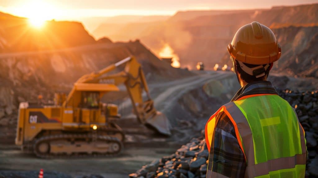
Construction
For construction companies, drones are a multi-tool. Before breaking ground, you can get perfect topographic surveys for site planning. During the project, you can fly the site weekly to track progress and generate high-resolution orthophotos for comparison against design plans.
You can also accurately measure stockpiles of dirt or gravel to know exactly how much material you have on hand. This ongoing site documentation helps resolve disputes and keeps stakeholders informed.
Agriculture
New York farmers use drones to create detailed elevation maps. This helps them plan for efficient irrigation and drainage across large areas. The georeferenced imagery can also reveal variations in crop health that are invisible from the ground, allowing for targeted application of resources.
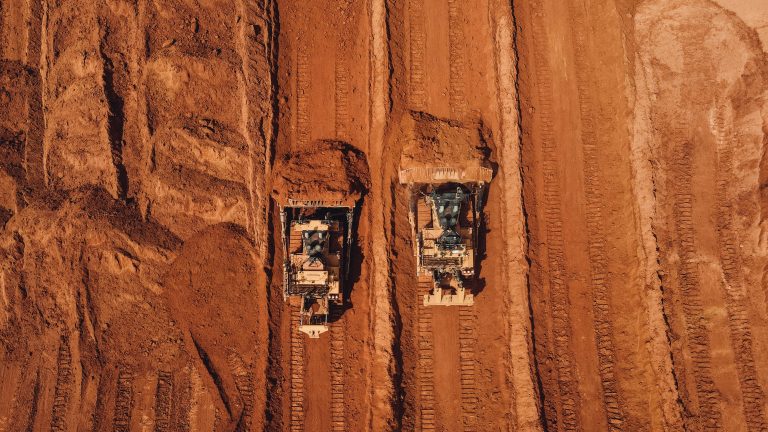
Aggregates (Quarries & Mines)
Keeping track of inventory in a quarry used to be a difficult and often inaccurate guessing game.
With a drone, you can fly over your stockpiles and get precise volume calculations in just a few hours. This makes inventory management and financial reporting much simpler and more accurate.
The safety benefit of not having people climb on unstable piles is also massive. These drone surveys provide a clear, safe, and efficient alternative.
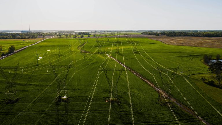
Infrastructure and Energy
Planning a new road, pipeline, or power line? Drones can perform high-resolution aerial mapping of long corridors quickly and safely. This helps engineers choose the best route and identify potential obstacles early in urban planning.
Drones are also excellent for select applications like facade inspections of bridges or buildings. They can spot issues without putting people in risky situations. This is also valuable for real estate developers assessing large commercial properties.
Choosing the Right Drone Surveying Partner in New York
Like any service, not all providers are created equal. You are trusting them with data that will form the foundation of your project. You need to hire a real professional.
First, make sure any operator you hire is FAA Part 107 certified. This is the law. It means they are a certified commercial drone pilot who understands the rules of flying safely and legally.
You should also look for a drone surveying firm with specific experience in land development. Ask to see examples of their mapping work. A professional company will provide highly accurate results in a format your engineering team can use.
Finally, ask about insurance. A professional operation will carry significant liability insurance to protect you and your project. Don’t be afraid to ask for proof, as this protects everyone involved and shows you’re working with a serious business.
Conclusion
The old way of surveying still has its place. But for most land development projects, it’s just too slow and provides too little information. The technology has changed the game.
Staying competitive means embracing tools that give you an edge in speed, cost, and quality. Aerial surveys provide a level of detail that was previously unimaginable. This comprehensive view helps you manage projects more effectively from start to finish.