Commercial Drone Photography for Project Milestones
You’ve been there before. Standing on the edge of a muddy construction site, trying to make sense of blueprints while shouting over the noise of machinery. You try to explain project progress to a client over the phone, but words just don’t capture the full picture.
The old way of tracking projects is broken, leaving you and your stakeholders in the dark.
But what if you could see everything, all at once, from a perfect vantage point? That’s the power of commercial drone photography for project milestones.
What’s the Big Deal with Drones on a Job Site?
For years, project managers relied on ground photos and written reports. The problem is, a picture of a foundation from eye level doesn’t show you the whole story.
You miss the context of the entire site, and these construction photos often raise more questions than they answer.
Drones change that completely by providing a comprehensive visual of the entire area.
They capture high-resolution drone photos and data from consistent viewpoints week after week, or milestone after milestone. It builds a visual story, something numbers just can’t do. You’ll easily watch the site grow and change.
How Commercial Drone Photography for Project Milestones Works
Getting this powerful data isn’t as simple as just sending a drone into the air.
A professional workflow from a qualified photography service ensures the information you receive is accurate, safe, and genuinely useful.
The process is broken down into a few simple stages to support your project management.
Step 1: Planning the Flight
A good drone operation starts on the ground with solid coordination planning. It’s about sitting down and figuring out exactly what you need to see from your construction drone photography. This means setting up predetermined flight paths to be flown repeatedly for consistent progress photos.
We decide on the frequency together. Do you need weekly updates for a fast-moving construction project, or monthly progress shots for a longer-term infrastructure build? This plan covers every detail of safety and air traffic law.
The Federal Aviation Administration (FAA) has strict rules for any drone operation, and a professional pilot handles all of that for you. We verify any flight zone limits and double-check that the entire operation complies with all applicable legal guidelines.
Step 2: Capturing the Data
Once the plan is set, the drone pilot visits your site to fly the mission.
They capture hundreds or even thousands of images from different angles while flying the planned route.
We’re looking at more than just basic pictures from the sky. Depending on the job, a drone can also carry sensors for thermal imaging to spot heat loss or LiDAR to create ultra-precise 3D maps of a site.
Step 3: Processing and Delivery
This is where the raw images turn into valuable project insights. High-resolution images captured by the drone are then precisely merged.
This digital compilation, commonly referred to as photogrammetry, creates a comprehensive visual. This creates a single, high-resolution map of your entire site, known as an orthomosaic map.
From this rich collection of points, we extract a variety of useful visual aids, including realistic 3D models and practical elevation maps. You’ll get a clear view of your project’s land and its structure. These services make the entire layout much easier to understand.
The Real Benefits for Your Project (and Bottom Line)
So, what does this all mean for your business?
- Crystal-Clear Stakeholder Communication. No more confusing phone calls trying to explain progress. You can send a link to a high-resolution map or a short drone video clip that shows exactly what’s been done. This keeps your clients, investors, and remote team members fully informed. And the progress photos? They’re perfect for showing off updates on social media.
- Catch Problems Before They Escalate. From the air, you can spot potential issues you’d never see from the ground. Consider identifying water drainage problems after a heavy rain or noticing an incorrect material delivery before it is installed. Catching these mistakes and identifying potential issues early can save you thousands in rework costs.
- A Safer Job Site. You can inspect dangerous or hard-to-reach areas without putting anyone at risk. Need to check the roof of a five-story building or the top of a cell tower? A drone can do it in minutes. Imagine how much easier it is when you can clearly show OSHA and your insurance provider that your construction site meets every safety standard.
- Track Construction Progress Like Never Before. Are you on schedule? Now you can prove it with aerial photos. Simply review drone maps from various days; you’ll see precisely how your project is progressing. For aggregate sites, this means accurately measuring the volume of stockpiles without manual surveys, a core part of drone surveying.
- Ironclad Project Documentation. You will have a complete, date-stamped visual record of your project from the first shovel of dirt to the final walkthrough. When a disagreement arises, this digital history becomes your strongest ally, serving as compelling legal evidence. It serves as undeniable proof of the work completed and the site conditions at any given time.
What Can You Actually See with Drone Aerial Photography?
Its many uses mean you can apply it almost anywhere. The use cases depend on your industry and the specific information you need to track.
For construction managers, you’re tracking earthwork, foundation pouring, and framing progress with an expert construction perspective. You can verify that retaining walls are built to spec or see how site logistics are flowing. This type of construction site monitoring gives you a daily command center view.
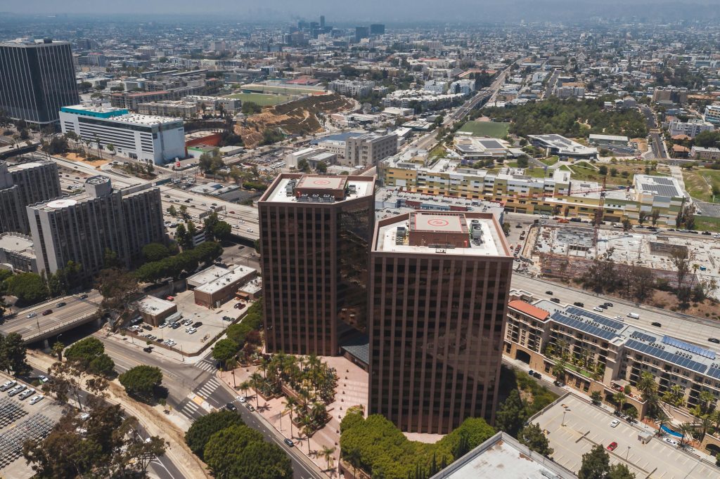
If you’re selling commercial property, a drone provides buyers with a whole new way to view it. Imagine seeing precisely where a property is located—how near it sits to highways, the everyday conveniences you need, and surrounding buildings.
During the construction phase, a commercial real estate drone can provide investors with compelling visual updates that build confidence and excitement.
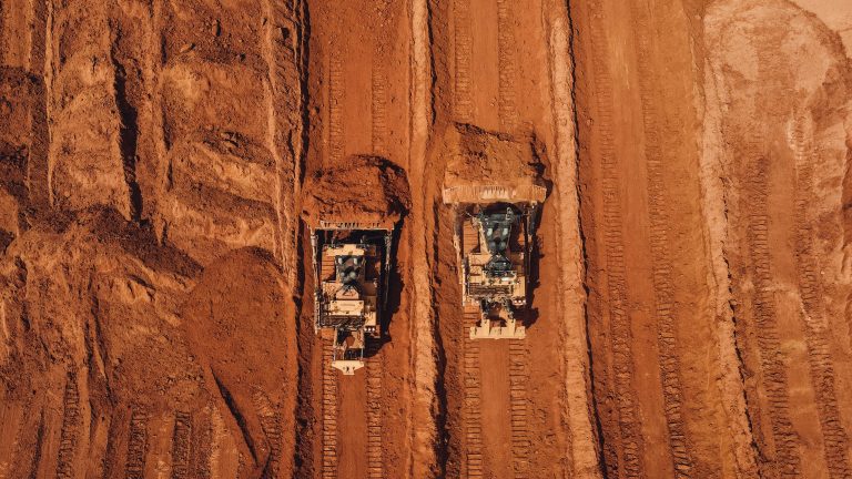
Drones completely change how aggregates and mining sites handle inventory. Counting stock becomes much simpler. You can get precise volumetric measurements of your stockpiles in a few hours through drone mapping. No more guesstimates, just hard data to run your business on.
Choosing a Drone Service Provider in the Northeast
When you’re trusting someone with the documentation of your multi-million dollar project, you want a true professional. There are a few key factors to consider when evaluating any drone services.
First, make sure they are FAA Part 107 certified. This is the law for any commercial drone operation in the United States, and it’s non-negotiable. They clearly understand. They fly both safely and with real expertise.
You’ll want a service provider who’s already done work for businesses just like yours.
A pilot who shoots real estate photography for residential homes may not understand the data requirements of a complex civil engineering project or large commercial real estate developments. Ask to see case studies or examples of work they’ve done for companies with similar construction projects.
You’ll find that a deep familiarity with the neighborhood gives you a significant advantage. Flying conditions can change fast in the Northeast.
A pilot who understands the local weather patterns and complex airspace, like around major metropolitan areas, will be more reliable and effective.
What will they deliver? And what can their software do? A professional drone service should provide more than just raw images. You want a dashboard that just makes sense, showing you your data without a fuss. For optimal efficiency, it must integrate seamlessly with your other programs, ensuring everything moves smoothly.
Finally, always ask for their certificate of insurance. A professional operator will carry significant liability insurance to protect you, your team, and your project site. If they can’t produce it, walk away.
Conclusion
The days of managing complex projects with binders of paper and folders of random photos are over. You’ll find this slow process just confuses things and drains your funds. Stepping up to a modern workflow is no longer just a nice idea; it’s a competitive necessity for success.
Adopting professional commercial drone photography for project milestones gives you unparalleled clarity and control.
Armed with accurate information, you can present your ideas clearly, identify and resolve roadblocks swiftly, and complete every project both on schedule and within its budget.