Orthomosaic Mapping for Construction Sites: A Guide
You’re probably right in the thick of it, managing a heap of different tasks on your building project.
Keeping projects on time and budget feels like a constant battle, doesn’t it?
Picture this: a truly sharp, exact look at your entire location.
You’d get it fast, without fuss, completely changing how you see things.
Orthomosaic mapping makes that happen.
What is Orthomosaic Mapping?
Drones fly over your construction site in a specific grid pattern during planned drone flights.
They take hundreds, sometimes thousands, of overlapping high-resolution images.
Special mapping software then stitches these drone images together.
The crucial part is that the software corrects for distortions caused by the camera lens, sensor tilt, and the ground’s terrain, creating a photogrammetrically orthorectified image.
Every point on an orthomosaic map is as if you’re looking straight down at it, offering a true top-down perspective.
This makes it incredibly useful for taking precise measurements from the aerial imagery.
The US Geological Survey provides insights into what an orthoimage is and why its accuracy is crucial for reliable data collection.
This means you can measure distances, areas, and even volumes directly from the map with surprising precision, unlike trying to gauge from outdated satellite imagery or less precise Google Maps views.
Why Your Construction Site Absolutely Needs This
Running a construction project, especially in busy areas like New York or Massachusetts, presents unique challenges. You are often dealing with tight spaces, complex logistics, and demanding timelines for any map construction.
This is where modern tools, such as construction orthomosaic maps, can provide a significant advantage, enabling project managers to stay ahead.
Imagine knowing precisely how much soil needs to be moved before a single shovel hits the ground, a critical factor for earthwork management.
Picture tracking your site’s progress, monitoring week by week with an accuracy previously unattainable through traditional methods.
This isn’t just a possibility; it’s a practical application of drone orthomosaic technology on your project site. Implementing drones for creating an orthomosaic map can revolutionize your workflow.
Here’s a look at how orthomosaic mapping benefits various aspects of construction management:
| Task Area | Traditional Method Challenges | Orthomosaic Mapping Solution | Primary Benefit |
|---|---|---|---|
| Initial Site Assessment | Manual surveys, often slow; limited visual data from outdated satellite images. | Rapid capturing aerial data with drones; comprehensive high-resolution images. | Speed, current site context, better initial understanding. |
| Design & Planning | Reliance on 2D blueprints; potential for unseen site conflicts. | Overlay designs on current, accurate 3D site models; identify potential clashes early. | Improved design accuracy, ability to catch conflicts, reduced rework. |
| Progress Monitoring | Infrequent site walks; subjective reports; difficulty conveying progress visually. | Regular drone orthomosaic maps provide objective visual timeline of the entire geographic area. | Accurate tracking, transparent reporting, early problem detection. |
| Earthwork & Stockpile Volumes | Estimates or manual, time-consuming measurements for stockpiles. | Precise volumetric calculations from 3D data generated by drone mapping. | High accuracy for material management, saving time and costs. |
| Safety & Inspections | On-foot inspections in potentially hazardous areas; some safety risks might be missed. | Remote inspection of the entire project site, including difficult-to-access areas. | Enhanced safety for personnel, more thorough identification of safety risks. |
| Stakeholder Communication | Static reports; delays in sharing information; misunderstandings. | Easily shareable, interactive drone maps and visuals for all project managers and stakeholders. | Clear communication, faster decision-making, improved collaboration. |
Better Planning from Day One
Before construction begins, an accurate orthomosaic map provides an excellent foundation for planning.
You see the project site as it truly is, not just as depicted in older plans or satellite images.
This helps architects and engineers create more precise designs based on current conditions.
They can identify potential issues early, such as unexpected terrain variations or drainage issues, saving costly changes later on.
You can overlay design plans onto the orthomosaic drone map to visually verify how they fit the actual terrain.
This visual check is powerful, fostering a better understanding of the project scope among all team members and helping to map out perfectly from the start.
Watch Your Project Grow, Accurately
Forget relying solely on site visits and written reports for progress monitoring.
With regular drone orthomosaic maps, you get a visual timeline of your construction.
You can compare the site’s condition from one week to the next, or even more frequently if needed.
Are things on schedule?
Are materials being placed correctly according to the plan?
You’ll see it all, providing a clear and objective record of development.
This allows you to catch conflicts or deviations from the plan much faster.
If a section is falling behind or if work is not aligning with the design, you’ll know promptly.
You can then take corrective action before small problems become big, expensive ones, ultimately saving time and resources.
Clear Communication for Everyone

Misunderstandings on a busy construction site can lead to mistakes and delays.
A detailed orthomosaic map acts as a universal language.
You can share it easily with your crew, subcontractors, clients, and investors.
Everyone involved sees the same, accurate picture of the project site, fostering better collaboration.
Discussions about progress, upcoming tasks, or identified problems become much more effective when you can point to a specific area on an accurate map.
This visual aid fosters better teamwork and ensures everyone is aligned.
Handle Earthwork Like a Pro
Moving dirt and managing materials effectively costs money and impacts project timelines.
Knowing exactly how much material you have in stockpiles or how much earth needs to be cut or filled is vital.
Orthomosaic maps, when combined with elevation data from the drone mapping process, enable you to calculate these volumes with great accuracy.
This helps you manage resources better, avoid over- or under-ordering materials, and verify contractor claims.
You obtain precise stockpile measurements quickly, often within hours of a drone flight, rather than waiting for traditional survey methods.
Safer Sites, Happier Crews
Safety on the construction site is always a top priority. Inspecting a large, active construction site can expose personnel to various safety risks.
Drones can fly over hazardous or difficult-to-access areas to collect data for infrastructure inspection without putting anyone in danger.
You can use the maps to identify potential safety issues, such as unsafe slopes, improperly stored materials, or inadequate fall protection, all from the safety of your office.
Keeping up with safety guidelines from organizations like OSHA for construction is easier with the enhanced oversight that drone orthomosaic maps provide.
How Orthomosaic Mapping for Construction Sites Actually Happens
Obtaining one of these incredibly useful maps involves a few key steps, blending smart technology with careful planning by a drone expert.
You might be surprised how efficient the entire process of creating an orthomosaic map can be.
The journey from drone flight to actionable drone maps is a well-defined one.
First, there’s flight planning.
You cannot just send a drone up and hope for the best results; a systematic approach is necessary.
The flight path for the drone flights is carefully designed using specialized drone mapping software to ensure the entire site is covered and that there’s sufficient overlap between the aerial photos for the photogrammetry software to work effectively.
The desired ground sampling distance (GSD), which determines the map’s resolution and level of detail, is also established at this stage.
Flying the Mission: Data Capture
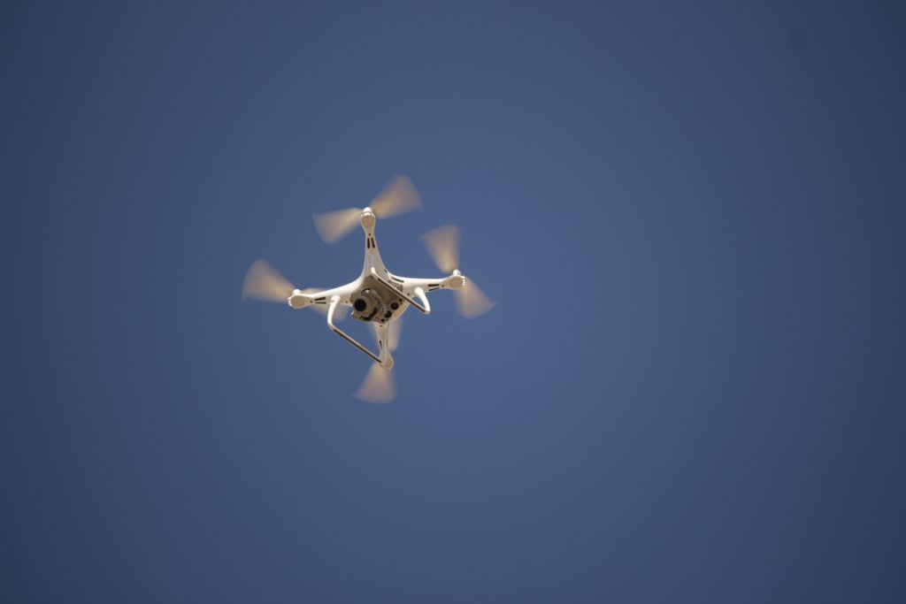
Once the plan is set, a certified drone pilot executes the flight.
The drone, often a sophisticated model equipped with a high-resolution camera, flies autonomously along the pre-programmed path.
It systematically captures hundreds or even thousands of geolocated images captured across the designated geographic area.
For enhanced accuracy, especially for survey-grade results, Ground Control Points (GCPs) are often used.
These are clearly marked targets placed on the ground whose exact coordinates are known and measured with precision survey equipment.
These GCPs help to precisely pin the map to the earth, ensuring the orthorectified image is globally accurate.
Adherence to regulations, such as those set by the Federal Aviation Administration for commercial drone operations, is crucial. Therefore, working with a licensed and experienced drone expert is essential for lawful and effective data collection.
Processing Power: Creating the Map
After the drone lands and the captured images, along with any GCP data, are retrieved, they are uploaded to specialized photogrammetry software or drone mapping software.
This is where the computational heavy lifting occurs.
The software analyzes the overlapping drone images, identifies common points between them, and calculates the 3D structure of the site.
From this detailed 3D model, it then generates the geometrically corrected orthomosaic map.
This processing can take several hours, or even longer, depending on the size of the area mapped, the number of images taken, and the desired level of detail.
The outcome is a high-resolution construction orthomosaic, ready for analysis and use by the project team.
Many mapping services now offer cloud-based processing, which can speed up this stage.
Using Your New Super-Map
What you receive at the end of the process is more than just a static image file; it’s a rich dataset.
You can view the orthomosaic map in GIS (Geographic Information System) software, CAD programs, or even web-based platforms designed for construction project management.
You can take precise measurements of distances, areas, and perimeters, annotate specific features or areas of concern, and track changes over time by comparing maps from different dates.
Many construction companies integrate these drone maps into their existing Building Information Modeling (BIM) workflows.
This enables direct comparison between the as-built conditions captured by the drone and the original design plans.
Beyond the orthomosaic itself, the data can be used to generate digital elevation models (DEMs), digital surface models (DSMs), 3D point clouds, and even basic drone video fly-throughs for visualization, offering a comprehensive view.
Getting Started with Orthomosaic Mapping
So, you see the substantial benefits of orthomosaic drone mapping.
You understand the process a bit more.
What’s next if you want to use this for your construction site or other projects?
The first step is typically to connect with a professional drone service provider or a mapping services company with a proven track record.
Look for companies with specific experience in construction projects or your particular industry.
Ask about their pilots’ certifications; they should all be FAA Part 107 certified to operate commercially.
Also, inquire about their insurance coverage and safety protocols, as these are critical for professional drone operations.
A reputable drone expert will be transparent about their qualifications and procedures.
You’ll need to provide them with some basic information about your project site.
This includes the precise location, the size of the geographic area you want mapped, and what your primary objectives are for using the map (e.g., progress monitoring, earthwork calculations, as-built verification).
Knowing your goals helps them plan the mission effectively, choose the right drones equipped for the job, and determine the optimal GSD for the high-resolution images.
They will advise on how best to map perfectly for your needs.
Turnaround time for receiving your final orthomosaic map and associated data can vary.
For smaller sites, you can expect to receive your map and reports within one to two days after the drone flight and data capture.
Larger, more complex projects, or those requiring very high precision and extensive data processing, could take a bit longer.
However, it’s generally much faster and often more cost-effective than traditional surveying methods for achieving this level of comprehensive site detail.
Conclusion
Ultimately, making smart decisions on a construction site comes down to having good, reliable information.
If you’re looking for a powerful way to improve planning, accurately monitor progress, enhance site safety, and foster clear communication, then investigating orthomosaic mapping for construction sites is a smart move.
It provides a level of detail, accuracy, and accessibility that older methods simply cannot match, far surpassing outdated satellite imagery or basic aerial photos.
By adopting technologies like precise drone-based orthomosaic mapping for construction sites, businesses throughout the Northeast and beyond can build more efficiently, manage resources more effectively, and improve their bottom line.