Enhancing Quarries: Volumetric Measurement with Drones For Quarries
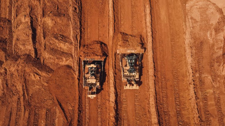
Managing a quarry means you are constantly dealing with giant piles of material. You know the ones. Those massive stockpiles of sand, gravel, and stone are your bread and butter.
But how much material is actually in them? Answering that simple question is often a huge headache. You need accurate inventory for sales, planning, and financial reporting.
And let’s be honest, the old ways of measuring are slow, often unsafe, and can be wildly inaccurate. This is where getting a volumetric measurement with drones for quarries changes everything. You’re probably here because you’ve heard about this drone technology but aren’t sure if it’s just hype.
You wonder if this commercial drone application can really fix the inventory problems that plague quarry operations. The short answer is yes, and using a drone is more straightforward than you might think. For businesses in New York, Pennsylvania, and across the Northeast, making a precise volumetric measurement with drones for quarries is becoming the new standard for stockpile management.
What Exactly is Volumetric Measurement with Drones?
Let’s break it down without confusing technical jargon. Think about how you measure a cup of flour. You pour it into a measuring cup with clear markings.
Drone volume measurement works on a similar idea, but instead of a cup, you are using advanced technology to create a super-detailed 3D model of your stockpile. A specialized commercial drone, often a model like the DJI Matrice, flies a pre-planned grid pattern over your quarry. The data collection process involves taking hundreds, or even thousands, of high-resolution, overlapping photos from different angles with a sensor like the DJI Zenmuse.
This collection of images is then fed into powerful software which creates a digital twin of your site. The software analyzes all the overlapping points in the photos to build 3D point clouds, which is a digital copy of your entire site made of millions of tiny data points. This creates an incredibly accurate 3D model, letting us calculate stockpile volumes with a high degree of precision.
The Old Way vs. The New Way: Why Make the Switch?
You are likely familiar with the traditional methods. Maybe you send an employee out with a GPS rover or a measuring wheel. Alternatively, you might hire a third-party survey crew every quarter, which can be costly and time-consuming to schedule.
These methods worked for a long time, but they have some serious drawbacks. Modern operations demand better data, improved safety, and higher operational efficiency.
The Headaches of Traditional Stockpile Measurement
Climbing up and down massive, unstable piles of aggregate poses a significant safety risk to workers. The Mine Safety and Health Administration (MSHA) even has alerts about the dangers of engulfment and falling materials from stockpiles. Every time you send someone out to walk a pile, you introduce a potential hazard and expose your operation to unacceptable risk.
Besides the safety concerns, these methods are incredibly slow and prone to human error. It can take a full day or more to measure just a handful of stockpiles. This slow process means you might only get inventory counts once a quarter, leaving your sales team guessing for months at a time.
Because surveyors can only take so many data points by hand, the final volume calculation is often more of an estimate than an accurate measurement. This lack of data accuracy can have significant financial implications. The goal is always to improve worker safety and get reliable numbers.
The Drone Advantage
Now, let’s look at how drones change the game. The benefits are clear and directly impact your bottom line. You get an entirely new level of insight into your operations.
A drone can fly over large areas of your entire quarry and capture all the necessary aerial data in just a few hours. Instead of waiting days for a survey crew, you get actionable data almost immediately. This speed lets you conduct surveys and perform a complete stockpile analysis monthly or even weekly, helping managers track progress continuously.
Safety also improves dramatically. With a drone, no one has to climb a single stockpile. The drone operator stays safely on the ground while the drone does all the work, which helps to improve safety on site.
Then there is the accuracy. Studies have shown that drone photogrammetry can achieve very high accuracy levels, often within 1-3% of traditional methods. Because drones capture millions of data points, not just a few dozen, the 3D model is a true representation of your stockpile’s shape, leaving very little room for error in your volume data.
This all leads to better data for better decisions. You’re not just getting a single number for stockpile volume. You get a complete 3D map of your site, which can be integrated with mining software to plan extraction, manage haul roads, and monitor changes over time.
The Step-by-Step Process for Volumetric Measurement with Drones for Quarries

Seeing how it all works can help you feel more comfortable with the technology. It’s a structured process that delivers consistent, reliable volume measurements every time. Here is what you can expect when you work with professional service providers.
Planning the Flight
Success starts with a good mission plan. Before the drone even takes off, the survey area is defined and any potential obstacles are identified. For the highest accuracy, we place Ground Control Points (GCPs) on the ground, which are crucial for getting precise volume data.
Flying the Mission
The pilot uses software to create an automated flight path. This path makes sure the drone flies in a consistent grid pattern, so the drones capture images with the right amount of overlap for accurate model creation. The flight itself is usually quick, often taking less than an hour for a typical quarry as drones are well-suited for covering large areas efficiently.
Processing the Data
After the flight, the images are uploaded to specialized photogrammetry software like DJI Terra or Pix4D. This is where the drone data processing happens.
The software analyzes every image, identifies common points, and stitches them all together to create that detailed 3D point cloud and digital surface model (DSM) of your quarry.
This stage of processing data transforms raw images into a measurable digital asset. This step is critical for accurate volumetric calculations.
Calculating the Volumes
With the 3D model ready, you can calculate stockpile volumes with just a few clicks. We use robust tools within the software to draw a digital boundary around the base of each stockpile.
The software then instantly performs the volumetric analysis and calculates the volume of all the material sitting above that defined base, giving you a precise measurement.This process simplifies volume calculation for dozens of stockpiles, reducing the time it takes to do so manually by a fraction. It is an effective way to measure volume accurately.
Getting Your Report

You don’t just get a spreadsheet with numbers. You get a comprehensive report that is easy to understand. It includes the volume data collection results for each pile, often converted to tonnage if the material density is known.You will also get orthomosaic maps and 3D models you can view yourself. This helps you see your inventory in a whole new way and share valuable insights with your team.
Getting the Most Accurate Results
When you’re making business decisions based on this data, you need to trust it. Data accuracy is everything. A few key factors are critical to getting survey-grade results you can depend on for financial reporting and stockpile management.
The use of Ground Control Points (GCPs) is probably the most important factor. Without them, a drone map is just a pretty picture with relative accuracy. GCPs tie the drone’s data to precise geographic locations on the Earth, correcting for any minor drift or distortion and delivering true survey-grade accuracy.
Weather also plays a part. Flying on a clear, overcast day is ideal because it minimizes harsh shadows that can obscure parts of a stockpile. High winds can affect the drone’s stability, so flights are always planned around calm weather conditions to get the sharpest images possible.
Finally, the equipment matters. Drones equipped with a high-resolution camera are essential to capture detailed images. In some cases, a LiDAR sensor may be used; LiDAR sensors capture data using laser pulses instead of photographs, which can be beneficial for vegetated areas, but photogrammetry is highly effective and more cost-efficient for most quarry stockpiles.
Beyond Stockpiles: Other Uses for Drones in Quarries
Getting a volumetric measurement with drones for quarries is a major benefit, but the data you collect has so many more uses. You are already flying the site, so why not use that data to improve other parts of your operation? This drone data can be a powerful asset for overall site management.
You can use the high-resolution maps from drone mapping for site planning and monitoring progress over weeks or months. You can watch how your pit changes and confirm your excavation plans are on track. The data can even be used to check blast performance by comparing maps from before and after a blast.
Haul road design and maintenance are another great application. The 3D models can show you the grades of your roads, helping you optimize them for fuel efficiency and reduced wear and tear on your heavy equipment. It’s all about using one set of data to solve multiple problems, from inventory to infrastructure.
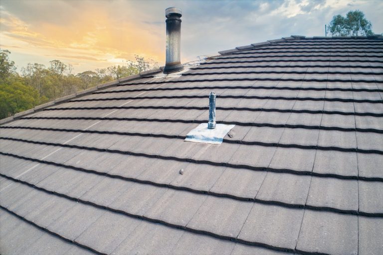
Other applications include monitoring areas designated for waste management to calculate capacity. For site reclamation projects, drone data can assess crop health and perform stand counts, applying principles from precision agriculture. Even simple tasks like roof inspections on site buildings can be done quickly and safely with a drone.
Common Questions We Hear
It’s natural to have questions when looking at new technology. Here are a few we often get from quarry managers in the Northeast.
How long does a typical survey take?
For most quarries, the actual flight time is less than an hour. The entire process, from setting up on-site to having the drone data ready for processing, usually takes just a few hours. This is a massive time savings compared to the days it can take a traditional crew.
Do I need to buy my own drone and software?
Not at all. While some large companies build in-house drone programs with tools like DJI Dock for automated flights, most quarries find it far more cost-effective to work with professional drone service providers. We handle everything from the flight planning and data capture to drone data management and delivering your final report.
You get all the benefits without the investment in hardware, software, and training. Managing the drone data processing and overall data management requires specific expertise that a service provider already possesses.
Is this really more accurate than sending my guy out with a rover?
Yes, because of the sheer density of data points. A surveyor walking a pile with a GPS rover might capture 50 or 100 points to define its shape. A drone captures millions of points from its sensors, creating a much more detailed and true-to-life surface that leads to more reliable volume calculations.
Is a LiDAR sensor better than a camera?
A LiDAR sensor excels in certain conditions, such as penetrating vegetation to map the ground beneath or navigating unusual terrain. For open stockpiles of aggregate, sand, or gravel, high-resolution cameras (photogrammetry) provide excellent accuracy at a more accessible cost. However, if you have the budget, LiDAR offers more accurate results for volumetric measurements.
Conclusion
Staying competitive means finding smarter, safer, and more efficient ways to work. For quarries in the aggregates and construction industry, old methods of inventory management are no longer good enough.
They are slow, risky, and fail to provide the accurate data you need to make informed business decisions.
Volumetric measurement with drones for quarries provides a clear solution to these old problems. By switching to drone-based surveys, you get fast, incredibly accurate stockpile data without putting your employees at risk.


