Drone Stockpile & Site Volume Tracking for 2026
Table of Contents
- What Drone Stockpile Tracking Replaces on a Jobsite
- Manual Survey vs Automated Volume Measurement: The Real Cost
- Earthworks Volume Calculation Best Practices for Accurate Results
- How to Track Project Progress With Drone Imagery
- Drone Construction Progress Tracking Software: What to Look For
- Troubleshooting Common Measurement Errors and Compliance Gaps
- Frequently Asked Questions
Last Updated: September 29, 2026
What Drone Stockpile Tracking Replaces on a Jobsite
Drone stockpile tracking is the practice of using aerial photogrammetry and LiDAR to measure material volumes and site progress from the air. At SkyeTech Aerial, we’ve watched this approach replace methods that have slowed earthworks teams down for decades.
Gone are the days of walking a pile with a tape and a rod. A drone flight captures thousands of georeferenced images in minutes, then software stitches them into a point cloud and digital terrain model. That model produces tonnage estimates, volume change reports, and a three-dimensional shape of every stockpile on site.
What it replaces:
- Manual survey crews spending hours per pile
- Inconsistent rod-and-tape measurements
- Delayed reporting that arrives after decisions are made
- Blind spots on remote or hard-to-reach material
The result is faster data, fewer disputes, and a clearer picture of material movement across the whole site.
Manual Survey vs Automated Volume Measurement: The Real Cost
Manual survey methods work, but they carry hidden costs that rarely appear on a budget line. A two-person crew, a total station, and a full day of walking piles adds up fast. Add weather delays, rework from bad data, and the labor hours spent reconciling numbers, and the true expense climbs.
Automated aerial measurement flips that equation. One FAA-certified pilot and a drone can cover an entire site in a single flight. Processing runs in the background, and results land in a dashboard the same day.
|
Factor |
Manual Survey |
Automated Drone Survey |
|---|---|---|
|
Time per stockpile |
Hours |
Minutes |
|
Crew size |
2+ people |
1 pilot |
|
Data format |
Field notes |
Point cloud, DTM |
|
Reporting speed |
Days |
Same day |
|
Safety exposure |
On-foot, at height |
Remote capture |
Building the Cost-Benefit Case for Your CFO
Most content on this topic stops at the table above. The harder, and more useful, question is how to translate a drone program into numbers a finance team will actually approve. The framework that works is avoided cost plus accelerated revenue, not a comparison of service fees.
Start with the labor line. A two-person survey crew billing at fully loaded rates for a full day per stockpile cycle is the baseline you are replacing. Multiply that by the number of piles, the number of measurement cycles per month, and the months in the project. That is your gross labor avoidance. Then subtract the drone program’s own costs: pilot time, processing, equipment amortization, and any per-flight service fee.
Next, add the rework line. Manual rod-and-tape measurements and total-station shots are prone to transcription errors, missed pile bases, and inconsistent reference points between visits. Every disputed tonnage that has to be re-measured is a second survey you already paid for. Automated photogrammetry and LiDAR produce a repeatable, georeferenced record, which collapses the re-measurement cycle.
Finally, add the billing-cycle line. Progress billings tied to verified material movement move faster when the verification data is same-day instead of end-of-week. For a general contractor, that is a cash-flow improvement, not just a reporting nicety. Frame the whole case as: labor avoided, rework avoided, and days shaved off the billing cycle. That is the language that survives a budget review.
Where Manual Still Wins
Automation is not universally better. On a single small pile measured once, a two-person crew with a total station can be faster end-to-end than mobilizing a pilot, flying, processing, and validating. Manual methods also hold up better in dense canopy where even LiDAR struggles to resolve a clean ground surface without additional ground control. The honest answer is that automation wins on repeat cycles, multi-pile sites, and any project where the data has to feed a downstream system. Manual wins on one-off, small-footprint, low-stakes measurements.
For a CFO conversation, frame it as avoided labor hours and faster billing cycles, not just a service fee.
Earthworks Volume Calculation Best Practices for Accurate Results
Earthworks volume calculation best practices start with a clean base surface and disciplined processing. Get the base wrong, and every number downstream is wrong too. Most errors we see trace back to a poorly defined reference plane or unverified ground control.
Setting a Reliable Base Surface and Digital Terrain Model
A digital terrain model represents the bare-earth surface beneath vegetation, equipment, and stockpiles. To build one you can trust, you need accurate ground control points and a consistent coordinate system. Skip that step and your cut-fill operations will be measured against a surface that never existed.
Set ground control with GPS-enabled targets, fly at consistent altitude and overlap, and process with photogrammetry or LiDAR depending on site conditions. LiDAR handles dense vegetation and low light better; photogrammetry is faster and cheaper for open sites.
Reading Confidence Scores and Verifying Survey Accuracy
Confidence scores tell you how much the software trusts each measurement. A low score usually signals thin image overlap, reflective surfaces, or motion blur. Treat any score below your threshold as a flag to re-fly, not a number to report.
Survey verification means cross-checking against known control points or a previous survey. If the model disagrees with your control by more than a few centimeters, stop and diagnose before publishing volumes.
How to Track Project Progress With Drone Imagery
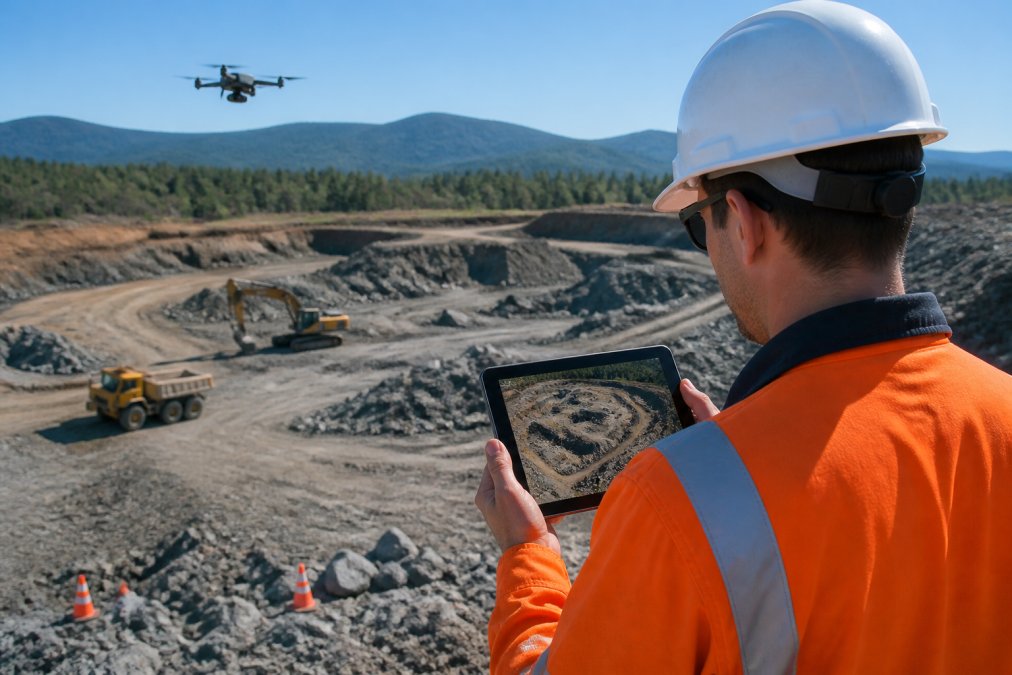
Tracking progress with drone imagery means flying on a fixed schedule and comparing each new model to the last. Consistency beats frequency. A weekly flight at the same altitude and overlap produces comparable data; irregular flights produce noise.
A simple workflow:
- Fly the same flight path each visit
- Process into an orthomosaic and point cloud
- Align to the previous survey using shared control
- Measure volume change between surfaces
- Publish the report to your project team
That cadence gives you real-time reporting on material movement and a clear record for subcontractor verification.
Comparing Planned vs Actual Cut-Fill Volumes Over Time
The most useful output is a planned-versus-actual comparison. Overlay your design surface on the current terrain model and the software calculates the delta. A growing gap between plan and actual is an early warning, not a surprise at month-end.
Track that delta weekly. If a cut area is behind schedule or a fill is running over, you can adjust haul routes and equipment before the overrun compounds.
Drone Construction Progress Tracking Software: What to Look For
Drone construction progress tracking software should do three things well: process accurately, report clearly, and integrate with the tools your team already uses. Everything else is a nice-to-have.
What matters most:
- Support for both photogrammetry and LiDAR
- Reliable volume and cut-fill tools
- Confidence scoring on every measurement
- Scheduled reporting and progress tracking
- Export formats your PM and finance teams can use
SkyeTech Aerial runs on best-in-class platforms including DroneDeploy, Pix4D, and DJI Terra, so you get proven processing without managing the software yourself. Our FAA-certified pilots fly to FAA Part 107 standards and every operation is fully insured.
Integrating Drone Data With BIM, ERP, and Project Management Tools
Integration is where most aerial data programs succeed or fail. If your survey lives in a separate silo, your team stops using it.
A disconnected system creates more work, not less. The right question to ask any vendor is: show me the last step, the report landing in the tool my PM already opens every morning.
Troubleshooting Common Measurement Errors and Compliance Gaps
Measurement errors usually trace to a handful of causes: poor ground control, inconsistent flight paths, unmodeled vegetation, or processing settings that were never validated. Each one is fixable, and each one is cheaper to prevent than to correct.
Common fixes:
- Re-fly with added ground control when confidence drops
- Standardize flight altitude and overlap across visits
- Use LiDAR where vegetation hides the ground surface
- Reconcile every new survey against a known control point
Frequently Asked Questions
How does drone photogrammetry improve stockpile volume accuracy?
Drone photogrammetry captures thousands of overlapping images and converts them into a point cloud, which produces a three-dimensional shape of each stockpile. That model is measured against a base surface to calculate volume, so the result reflects the real pile rather than a handful of tape measurements. Survey accuracy at centimeter level means tonnage estimation and material quantities stay defensible for billing, subcontractor verification, and inventory reconciliation.
What is the difference between site volume calculations and automated progress tracking?
Site volume calculations answer a point-in-time question: how much material is in this stockpile or how much dirt has moved since the last flight. Automated progress tracking answers a trend question: is the work keeping pace with the plan. The same drone data feeds both. Volume calculations compare current surfaces to a base surface, while progress tracking compares each new survey to the schedule and the design model over weeks or months.
How often should construction sites be scanned for progress tracking?
Most active earthworks sites benefit from a flight every one to two weeks, with more frequent scans during peak cut-fill operations or before a progress billing cycle. Sites with slower moving work, such as utility corridors or solar installations, can often run monthly and still catch grading errors early. The right cadence depends on how quickly the site changes and how often you need to report to owners or lenders.
Can drone data integrate with the project management software we already use?
Yes. Drone surveying platforms export orthomosaics, point cloud data, and volume reports in standard formats that connect to common construction project management tools, BIM environments, and ERP systems. Before you commit to a provider, ask which file types they deliver and whether their platform pushes data directly into your existing workflow. That answer determines whether you get real-time reporting or another disconnected spreadsheet.