How to Plan Drone Inspection for Remote Pipeline Assets
Last Updated: November 19, 2026
Quick Summary
Drone inspection for remote pipeline assets requires airspace authorization, written right-of-way access agreements, a defined defect list, ground control points, and a data storage plan before the first flight. Plan corridors in segments with consistent altitude and overlap so imagery stitches into a seamless orthomosaic and change detection stays reliable.
- Start landowner access conversations weeks ahead, since agreements take the longest to secure.
- Set fixed waypoints and reuse the same route each flight to make change detection possible.
- Thermal surveys work best around dawn or on overcast days, not in midday sun.
- Fly lower to resolve fine defects, but expect more passes, batteries, and processing.
- Pair each defect in the report with a location, severity, and recommended action.
Table of Contents
- What You’ll Need Before Your First Pipeline Flight
- Drone Inspection Flight Planning for Long, Remote Corridors
- Thermal Drone Pipeline Inspection and Sensor Selection
- Pipeline Inspection Data Analysis: From Raw Imagery to Defects
- Building a Drone Inspection Report Template That Drives Repairs
- Comparing Inspection Methods and Evaluating Service Providers
- Protecting Drone Data and Meeting FAA Compliance
- Request a Flight Plan and Quote for Your Pipeline Corridor
- Frequently Asked Questions
What You’ll Need Before Your First Pipeline Flight
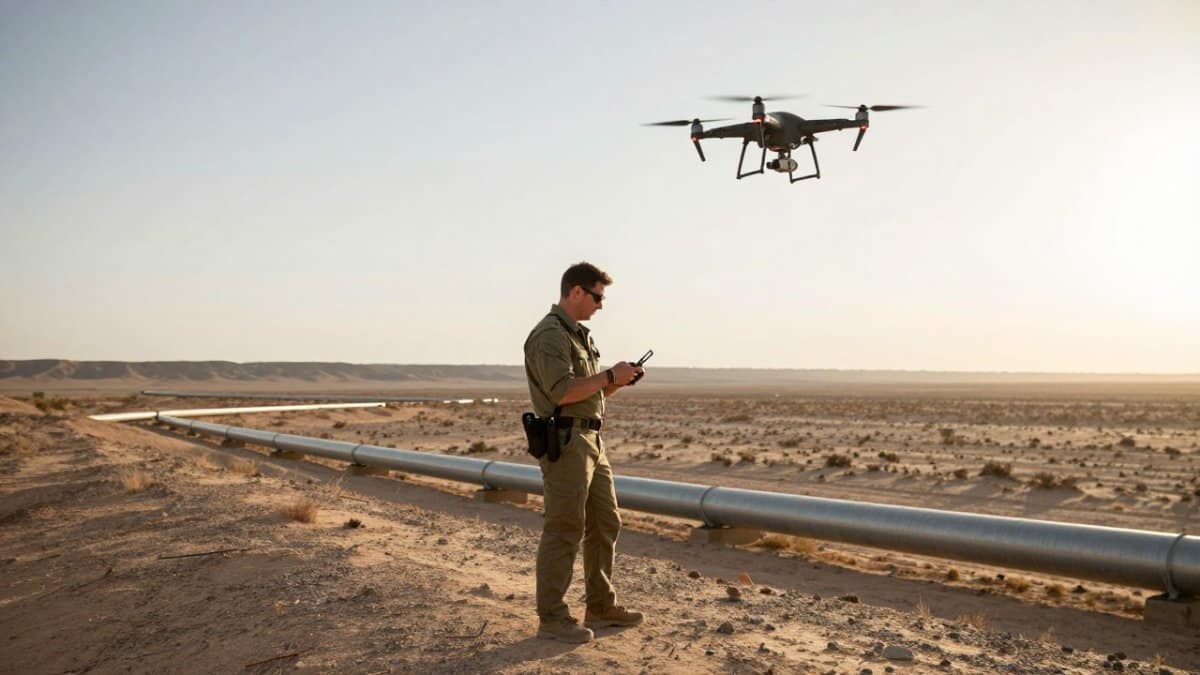
Drone inspection for remote pipeline assets starts long before the props spin. SkyeTech Aerial treats every corridor flight as a data project first and a flying job second, because the imagery is only as useful as the plan behind it. Below, we’ll show you exactly what to assemble before your first flight so the data comes back clean, defensible, and ready for analysis.
Here is the short list we walk every client through:
- Airspace authorization: Confirm the corridor sits in controlled or uncontrolled airspace and that the flight complies with applicable FAA rules.
- Right-of-way access agreements: Written landowner permission for launch and recovery points along the pipeline corridor.
- A defined defect list: Know what you’re hunting (corrosion, encroachment, surface conditions) before you choose a sensor.
- Ground control: Surveyed checkpoints or a base station for centimeter-level accuracy.
- A data storage plan: Where imagery lands, who can access it, and how long it’s retained.
What most guides miss is that the access agreements take the longest. Start those conversations weeks ahead, not days.
Drone Inspection Flight Planning for Long, Remote Corridors
Flight planning for long, linear assets is a different discipline than mapping a compact site. A pipeline corridor may run for miles through terrain with no road access, so you plan in segments and stitch them later.
We break corridors into manageable blocks, each with its own launch point, altitude, and overlap settings. Consistent altitude and sidelap are what let the images merge into a seamless orthomosaic instead of a patchwork.
Setting Automated Flight Paths and Waypoints
Automated flight paths do the heavy lifting on repeat visits. Set waypoints at fixed altitudes with consistent overlap, then reuse the same route every flight. That consistency is what makes change detection possible: when the camera position matches last month’s, a new crack or a shifted soil bank stands out immediately.
Keep waypoint spacing tight enough to hold overlap, and log the exact route so a different pilot can reproduce it.
Battery Life, Weather Windows, and BVLOS Limits
Battery life and weather are the two realities that break the prettiest flight plan. Cold mornings drain cells faster, and wind gusts cut usable flight time. Plan each sortie around your real endurance, not the spec sheet, and keep spare batteries warm in the truck.
Beyond visual line of sight, or BVLOS, requires specific FAA authorization. Do not assume you can fly the whole corridor in one pass. Build the plan around approved operations, and keep a weather window buffer in the schedule.
Thermal Drone Pipeline Inspection and Sensor Selection
Thermal drone pipeline inspection detects leaks and thermal anomalies by reading surface temperature differences. It is one sensor in a toolkit, not a universal answer. The payload you choose should follow the defect, not the other way around.
How Each Payload Actually Finds a Defect
A visual camera records reflected light, so it shows surface conditions, encroachment, and right-of-way changes at high resolution. It cannot see under vegetation or into the soil, and it struggles in low light.
A thermal camera records emitted heat. A small leak or a buried line with different thermal mass shows as a temperature contrast against the surrounding ground. The catch is that contrast depends on conditions: thermal surveys work best in the hours around dawn or on overcast days when the sun is not heating the surface unevenly. Midday sun can wash out the anomaly you are hunting.
LiDAR fires laser pulses and measures return time to build precise geometry. It produces accurate terrain and structure models where vegetation or low light defeats photogrammetry, and it gives you a bare-earth surface under canopy. The trade-off is cost and file size: LiDAR datasets are heavier to store and process than imagery. Because the added detail comes with larger files and processing demands, integrating LiDAR sensors on a carbon drone also calls for planning around payload, storage, and field workflows.
Resolution, Altitude, and the Trade-Off Nobody Mentions
Ground sample distance, or GSD, is the real number to plan around. It is the size of one pixel on the ground, and it falls as you fly higher. A visual survey that needs to resolve a hairline crack demands a much lower altitude than a corridor overview flight. Lower altitude means more passes, more batteries, and more processing.
Thermal sensors usually carry lower resolution than visual cameras, so thermal flights often need to fly lower to get usable detail. That directly shortens the corridor you can cover per sortie.
Watch out: picking a sensor because it is the newest or most expensive, rather than because it matches the defect list, wastes a flight and a processing cycle. If you need bare-earth terrain under canopy, a visual camera alone will not deliver it. For a deeper look at payload trade-offs, our team explains the benefits of LiDAR for site inspection.
Pipeline Inspection Data Analysis: From Raw Imagery to Defects
Pipeline inspection data analysis turns raw imagery into a defect list someone can act on. The flight is the easy part; the processing is where value is won or lost. Most guides stop at naming the outputs. The useful part is the chain that produces them.
The Processing Chain, Step by Step
A point cloud is a dense set of 3D coordinates built from overlapping images or LiDAR returns. An orthomosaic is a geometrically corrected, stitched map. Together they let you measure, compare, and archive asset integrity over time.
Getting there follows a repeatable sequence:
- Ingest and geotag. Match each image to its GPS position and ground control points so the model lands in the right place.
- Align and build. Overlapping images are matched into a sparse cloud, then a dense cloud, then a mesh and orthomosaic. LiDAR skips the matching step and goes straight to geometry.
- Classify and clean. Ground, vegetation, and structures are separated so measurements reflect the asset, not the weeds around it.
- Detect and score. Defects are flagged, measured, and ranked by severity against your defect list.
- Package. Results are exported into the report template with georeferenced imagery and recommended actions.
Post-Processing Automation: The Gap Most Guides Skip
Watch out: automation is only as good as the consistency of the flight. If altitude, overlap, and camera settings drift between visits, the model has nothing stable to compare against and change detection produces false alarms. If you are building point clouds in-house, our walkthrough on processing LiDAR point clouds for construction projects covers the workflow step by step.
Data Management and Security
High-resolution imagery of critical infrastructure is sensitive, and the cloud pipeline is where it is most exposed. Decide retention up front: how long raw captures are kept, and whether the client or the provider owns the archive. A clear data-handling agreement before the first flight prevents disputes later.
Building a Drone Inspection Report Template That Drives Repairs
A drone inspection report template should drive repairs, not sit in a folder. The best reports pair each defect with a location, a severity, and a recommended action.
Build the template around these fields:
- Asset ID and chainage: where on the corridor the defect sits.
- Defect type and severity: corrosion, encroachment, surface condition, thermal anomaly.
- Georeferenced imagery: the photo tied to coordinates.
- Recommended action and priority: repair, monitor, or re-inspect.
Comparing Inspection Methods and Evaluating Service Providers
Choosing a method comes down to access, frequency, and risk. Here is how the main options stack up.
| Method | Best For | Main Limitation |
|---|---|---|
| Ground crew walk | Short, accessible segments | Slow, safety exposure |
| Manned helicopter | Very long corridors | High cost, weather sensitive |
| Drone inspection | Remote, repeatable coverage | Battery and BVLOS limits |
When evaluating service providers, ask for FAA Part 107 compliance, insurance, sensor options, and a sample report. To see how UAV work compares with traditional approaches, review our UAV inspection services for power lines, which follow the same corridor logic.
Protecting Drone Data and Meeting FAA Compliance
Two things sink otherwise solid programs: insecure data and compliance gaps. Cybersecurity of drone data matters because high-resolution imagery of critical infrastructure is sensitive. Encrypt storage, control access, and know where every file lives.
On compliance, fly under FAA Part 107 and keep current waivers on file. For a fuller compliance walkthrough, read our guide to drone safety standards for infrastructure. Battery life and weather remain the operational limits to plan around every season.
Request a Flight Plan and Quote for Your Pipeline Corridor
The hardest part of remote pipeline monitoring isn’t the flying. It’s building a repeatable system that turns corridor imagery into repairs your team can schedule.
That’s where we come in. SkyeTech Aerial pairs FAA-certified pilots with centimeter-level photogrammetry and LiDAR, flown to FAA Part 107 standards and fully insured. We deliver 3D models, orthomosaics, and site analytics that help you spot issues early and keep assets on schedule.
Ready to plan your corridor? Request a free quote and get a flight plan built around your pipeline.
Remote corridors punish guesswork. A disciplined flight plan, the right sensor, and a report template that drives action turn drone inspection for remote pipeline assets into a maintenance advantage instead of a folder of pretty pictures. Get started with SkyeTech Aerial and turn your corridor data into scheduled repairs.
Frequently Asked Questions
How do you plan a drone inspection for a remote pipeline?
Start with the corridor map and split it into flyable segments based on battery range and line of sight. File the right-of-way access, set automated flight paths with overlap for photogrammetry, and schedule around weather windows. Confirm FAA Part 107 clearance and any BVLOS waivers before launch day. A written flight plan that lists waypoints, sensor payload, altitude, and emergency landing zones keeps each visit repeatable so data from one inspection can be compared directly to the next.
Can drones use thermal imaging to inspect pipelines?
Drone-based thermal imaging is one method used to screen pipelines for surface temperature differences. It narrows the search but does not replace pressure testing or direct assessment on the ground.
What are the limitations of drone pipeline inspections?
Battery life caps how much corridor you cover per flight, and wind, rain, or extreme heat can ground a crew for days. Dense vegetation and buried sections hide defects from the air, and subsea inspection needs different equipment entirely. Data volume is another constraint: a long corridor generates thousands of images that need processing before anyone can act. Plan for weather slack in the schedule and budget time for pipeline inspection data analysis so findings reach maintenance crews instead of sitting in a folder.
How do you turn drone inspection data into maintenance actions?
A drone inspection report can tie each defect to a location, severity rating, and photo, so the findings can be acted on by maintenance planners.