Drone Photogrammetry vs Manual Surveying: 2026 Guide
Table of Contents
- Drone Photogrammetry vs Manual Surveying: Core Differences
- Accuracy and Precision in Drone Surveys
- Ground Control Points for Drone Mapping
- Photogrammetry vs LiDAR for Construction
- FAA Part 107 Requirements for Surveying
- Speed, Cost, and Workflow Integration
- Safety and Risk Mitigation in Aerial Mapping
- When to Use Drone Surveying vs Manual Methods
- Frequently Asked Questions
Last Updated: October 9, 2026
Drone Photogrammetry vs Manual Surveying: Core Differences
Drone photogrammetry and manual surveying represent two fundamentally different approaches to collecting site data. At SkyeTech Aerial, we work with both methods daily, and the choice between them shapes everything from project timelines to measurement accuracy.
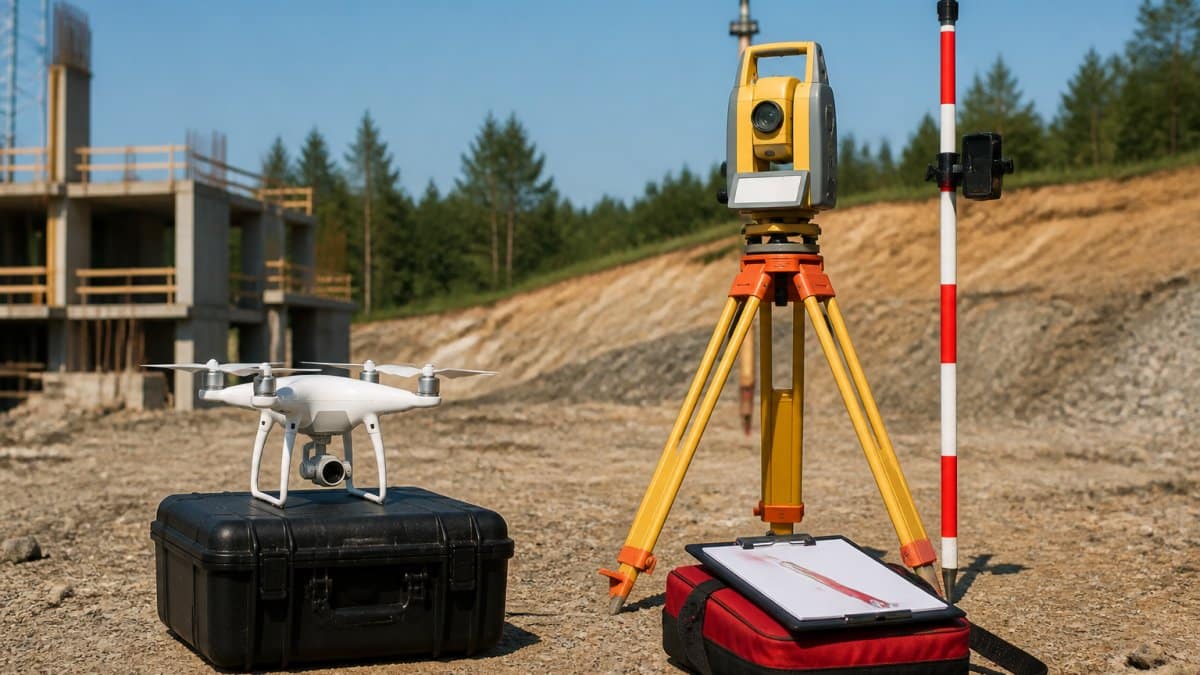
Drone photogrammetry uses aerial cameras and advanced software to create 3D models and orthomosaics from overlapping images. The process relies on computational geometry to stitch thousands of photos into a unified dataset. Manual surveying uses ground-based instruments, total stations, GPS units, measuring tapes, to capture individual points and distances. One is automated and scalable; the other is methodical and hands-on.
The real difference isn’t which is “better.” It’s which solves your specific problem faster, cheaper, and with acceptable accuracy for your use case.
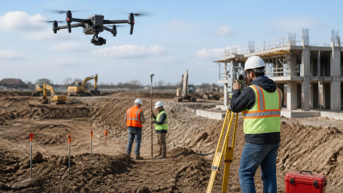
Drone photogrammetry excels at large-area coverage and rapid data acquisition. Manual surveying wins when you need sub-centimeter precision on specific points or must work in dense vegetation where aerial imagery fails.
Accuracy and Precision in Drone Surveys
Accuracy in drone surveys depends on three factors: camera resolution, flight altitude, and ground control point placement. Drone photogrammetry typically achieves 2-5 centimeter horizontal accuracy when properly executed with ground control points. Manual surveying can reach millimeter-level precision on individual points, but only for the specific locations you measure.
The critical insight most guides miss: accuracy isn’t uniform across a drone dataset. Your orthomosaic might be accurate to 3 centimeters in the center of your survey area but drift to 8-10 centimeters at the edges. Manual surveys give you precise data wherever you measure, but zero data everywhere else.
For construction site progress tracking, 5-centimeter accuracy is usually sufficient. You can detect major grading errors, verify concrete pours, and track stockpile volumes. For utility mapping or boundary disputes, you may need the point-level precision that manual methods provide.
Drone photogrammetry delivers area-wide accuracy adequate for most construction tasks. Manual surveying delivers pinpoint precision for critical control points. Many teams use both, drones for overview, manual methods for verification.
Ground Control Points for Drone Mapping
Ground control points (GCPs) are the foundation of accurate drone photogrammetry. These are marked locations on the ground with known coordinates, captured by your drone and used by processing software to anchor your entire 3D model to real-world space.
Without GCPs, your drone data is geometrically correct but spatially unanchored, your 3D model might be perfectly shaped but shifted 10 meters from its true location. With GCPs, your model locks to actual coordinates.
Establishing GCPs requires manual effort: you place targets on the ground, measure their positions using RTK-GPS or a surveyed total station, then include those targets in your drone imagery.
This is where drone photogrammetry and manual surveying overlap. Many teams use manual surveying to establish GCPs, then drone photogrammetry to map the rest of the site. It’s the hybrid approach that combines the speed of drones with the precision anchoring of traditional methods.
Photogrammetry vs LiDAR for Construction
Photogrammetry and LiDAR are complementary technologies, not alternatives. Photogrammetry uses visible light and image overlap to infer 3D structure. LiDAR uses laser pulses to directly measure distances to objects.
Photogrammetry excels in open areas with good lighting and clear features. It produces high-resolution color orthomosaics and detailed surface models. LiDAR excels in dense vegetation, poor lighting, and situations where you need to see through canopy to the ground.
For construction sites, photogrammetry alone is usually sufficient. Your site has clear features, adequate lighting, and minimal vegetation. LiDAR adds cost and complexity without proportional benefit for most construction tasks.
However, LiDAR becomes valuable for infrastructure inspection, pipelines through forest, transmission line corridors, or bridge underbelly assessment where vegetation obscures the target.
Use drone photogrammetry for construction site progress tracking, volumetric calculations, and 3D site models. Add LiDAR only if you’re mapping through dense vegetation or inspecting infrastructure in challenging terrain.
FAA Part 107 Requirements for Surveying
Any commercial drone operation in the United States requires compliance with FAA Part 107. This regulation governs who can fly, where they can fly, and how they must operate.
Key requirements:
- Remote pilot must hold an FAA Part 107 certificate (requires passing a knowledge test)
- Drones must stay within visual line of sight of the operator
- Maximum altitude is 400 feet above ground level
- Operations are restricted near airports and over people
- Night flights require special waivers
- Flights over private property require landowner permission
For construction sites, Part 107 compliance is straightforward. Your site is typically away from airports, you can maintain visual line of sight, and you have landowner permission. The main constraint is the 400-foot altitude ceiling, sufficient for most construction sites but limiting for very large areas.
SkyeTech Aerial operates all flights to Part 107 standards with FAA-certified pilots. This ensures your data is collected legally and your operation is insured. Non-compliance creates liability exposure and voids insurance coverage if something goes wrong. Professional oversight remains equally critical when interpreting the data gathered during aerial roof inspections to ensure that final measurements reflect the true structural condition of the property.
Operating drones commercially without Part 107 certification is illegal and exposes your company to FAA fines up to $27,500 and potential criminal liability. Always verify your vendor is FAA-certified before engaging drone services.
Speed, Cost, and Workflow Integration
Speed is the most cited advantage of drone photogrammetry, but the real story is where the time goes. Data collection is only one phase of a survey project.
Field collection time. A two-person manual crew using a total station and RTK-GPS typically captures a few hundred points per day on a site with moderate detail.
Post-processing time. This is where most comparisons stop, and where the trade-off actually flips. Drone imagery must be processed into a usable product. A typical photogrammetry pipeline includes:
- Image quality review and culling of blurry or poorly exposed frames
- Alignment and bundle adjustment to solve camera positions
- Dense point cloud generation
- Mesh or digital surface model creation
- Orthomosaic stitching and color balancing
- Ground control point integration and accuracy reporting
For a 50-acre site with 1,500 to 2,500 images, processing on a well-configured workstation commonly takes several hours to overnight.
The net effect. Drone photogrammetry front-loads time into processing; manual surveying spreads time across field days. For a single small site, manual methods can finish sooner end-to-end.
Workflow integration. Drone outputs, orthomosaics, digital surface models, point clouds, and volume reports, import directly into common construction and design platforms.
Hybrid workflows. The most efficient teams do not treat these as competing methods.
Compare methods on total project hours, not just field hours. Drone photogrammetry usually wins on field time and loses on processing time; the hybrid approach is often the fastest end-to-end path.
Safety and Risk Mitigation in Aerial Mapping
Safety is the most under-discussed factor in the drone-versus-manual decision, and it is often the one that changes the answer. Manual surveying puts people in the field, and the field is where injuries happen.
Where manual surveying creates exposure. A ground crew collecting data on slopes, roadways, structures, or industrial sites faces a predictable set of hazards:
- Slips, trips, and falls on uneven or steep terrain
- Struck-by and traffic exposure when working along roadways or rail corridors
- Falls from height when measuring elevated features, roofs, or bridge decks
- Heat stress and dehydration during extended summer field days
- Repetitive strain from carrying and setting equipment across long distances
- Exposure to active construction equipment and moving machinery
The Bureau of Labor Statistics has long identified falls, struck-by incidents, and heat illness as leading causes of workplace fatalities in construction and related fields. Surveying crews are not exempt from those categories.
How drone operations change the risk profile. A drone flight replaces the need for a crew to physically occupy most of the survey area. The operator stands at a launch point, maintains visual line of sight, and captures the site from above. The hazards that remain are different in kind and generally lower in severity:
- Equipment damage or loss from a crash or flyaway
- Battery failure or thermal issues
- Weather and wind constraints that ground the flight
- Airspace conflicts with manned aircraft
- Public privacy and nuisance concerns
These risks are managed through pre-flight checklists, maintenance schedules, weather minimums, and airspace coordination. They are operational risks, not personal injury risks.
The safety ROI. The financial case for drone safety is not just insurance premiums.
Where drones do not remove risk. Drones do not eliminate field work entirely. Ground control point establishment, utility locating, and boundary verification still require people on site.
A drone program without a written safety plan, documented pilot training, and a maintenance log is not a safety improvement. It is a different set of risks with no controls. Ask any vendor for their safety documentation before awarding work.
Choose drone photogrammetry when the survey area includes steep slopes, active roadways, elevated structures, or industrial hazards. The safety benefit alone often justifies the switch, even when accuracy requirements are modest.
When to Use Drone Surveying vs Manual Methods
Choose drone photogrammetry when:
- Your site exceeds 5 acres
- You need rapid data collection (same-day turnaround)
- You’re tracking progress over time (drones provide consistent, repeatable coverage)
- Terrain is accessible for flight operations
- You can tolerate 2-5 centimeter accuracy
Choose manual surveying when:
- Your site is small and focused (under 5 acres)
- You need sub-centimeter precision on specific control points
- Dense vegetation or structures block aerial access
- You’re establishing ground control points for drone operations
- Your budget is minimal and timeline is flexible
The hybrid approach, using drones for overview and manual methods for critical control points, is increasingly common. This combination gives you the speed and coverage of drones with the precision anchoring of traditional surveying.
Frequently Asked Questions
Are drones used for surveying?
Yes. Drones equipped with cameras and sensors perform photogrammetry and LiDAR surveying to capture aerial imagery and 3D point clouds. Drone photogrammetry generates orthomosaics and 3D models by processing overlapping images, while LiDAR drones emit laser pulses to measure terrain and structures. Both methods are faster and safer than manual surveying for many construction and infrastructure applications. FAA Part 107 certification is required to operate drones commercially for surveying work.
How does drone photogrammetry compare to traditional land surveying in terms of accuracy?
Drone photogrammetry with ground control points (GCPs) achieves centimeter-level accuracy comparable to manual surveying. GCPs are precisely surveyed ground markers that anchor the drone data to real-world coordinates, improving georeferencing accuracy. Manual surveying provides point-specific measurements but covers smaller areas slowly. Drone photogrammetry captures entire sites in one flight, generating dense point clouds and orthomosaics with consistent accuracy across the full survey area, making it more efficient for large projects.
What are the primary safety benefits of using drones for site surveying?
Drones eliminate the need for personnel to work at heights, access confined spaces, or enter hazardous areas like active construction zones or unstable terrain. Operators control flights from a safe distance, reducing fall risks, equipment injury, and exposure to moving machinery. This is especially valuable for roof inspections, stockpile measurements, and remote infrastructure assessment. Drone operations also reduce site congestion and minimize disruption to active work, lowering overall incident risk.
Can drone photogrammetry replace manual surveying for all construction projects?
No. Drone photogrammetry excels for large-area coverage, progress tracking, and 3D modeling, but manual surveying remains necessary for precise boundary surveys, utility locates, and legal property descriptions. Dense vegetation can limit photogrammetry accuracy because the camera cannot see ground features. Many projects use hybrid workflows: drones capture broad site data and orthomosaics, while manual surveying validates critical measurements and ensures regulatory compliance. The best approach depends on project scope, required precision, and site conditions.
What regulatory requirements must be met for drone-based site mapping?
Drone operations for commercial surveying must comply with FAA Part 107 regulations, which require a Remote Pilot in Command certificate. Operators must maintain visual line of sight, fly below 400 feet, and avoid populated areas. Insurance and liability coverage are essential. Some projects also require airspace authorization from the FAA. SkyeTech Aerial’s FAA-certified pilots ensure all flights meet Part 107 standards and project-specific compliance requirements, reducing regulatory risk and ensuring data integrity.
The choice between drone photogrammetry and manual surveying isn’t either/or. It’s about matching the tool to your project requirements. SkyeTech Aerial helps construction teams and infrastructure professionals integrate both methods into workflows that deliver faster project timelines, better accuracy, and safer operations. Request a free quote to see how drone photogrammetry can accelerate your next survey.