5 Best Drone Software for Construction Site Tracking
Table of Contents
- Why Drone Software Matters for Construction Site Tracking
- Quick Comparison: Top Drone Software for Construction
- DroneDeploy: Best for Construction Site Progress Monitoring
- Construction Drone Mapping Software: DJI Terra and Pix4D
- Construction Site Progress Tracking Software: Birdi and Propeller Aero
- Drone Survey Accuracy for Earthworks and Measurement
- Drone Mapping Workflow for Construction: Planning, Capture, and Delivery
- How to Choose the Right Drone Software for Your Project
- Frequently Asked Questions
Last Updated: October 7, 2026
Why Drone Software Matters for Construction Site Tracking
Construction teams struggle to verify progress across jobsites, catch errors early, and keep accurate records without slowing daily operations. Traditional documentation, manual surveys, photography, spreadsheets, is slow, full of gaps, and hard to compare over time.
Drone software for construction site tracking transforms project monitoring.
Below, we cover the 5 best drone software for construction site tracking and how to choose the right one.
Quick Comparison: Top Drone Software for Construction
Most roundups list tools and stop there. Construction buyers need to know which platform supports progress tracking, measurement, collaboration, and their existing systems. The matrix below compares the five options on the criteria that matter most, followed by the pricing, integration, accuracy, and procurement details most reviews skip.
| Software | Best For | Progress Tracking | Mapping & 3D | Measurement | Collaboration | Integrations | Pricing Model |
|---|---|---|---|---|---|---|---|
| SkyeTech Aerial | Teams that want expert collection plus analysis | Week-over-week visual records, subcontractor verification | Photogrammetry and LiDAR, orthomosaics, 3D models | Volumetric and grade checks with ground control | Reports delivered to project stakeholders | Outputs handed off to common project workflows | Service-based; scoped per project |
| DroneDeploy | Recurring site progress tracking | Automated flight planning, timeline views | 2D maps, 3D models, orthomosaics | Area and volume tools | Shared maps, annotations, team access | Procore, Autodesk Construction Cloud | Subscription; contact vendor for tiers |
| DJI Terra | Teams flying DJI aircraft | Repeat mission capture | 3D reconstruction, orthomosaics | Basic measurement tools | Local project sharing | Limited outside the DJI ecosystem | Perpetual license or subscription; contact vendor |
| Pix4D | Photogrammetry and surveying workflows | Repeat capture supported | Advanced 3D models, orthomosaics, point clouds | Survey-grade measurement with control | Desktop and cloud collaboration options | CAD, GIS, and common data formats | Subscription and perpetual options; contact vendor |
| Propeller Aero | Earthworks and stockpile tracking | Site timeline comparisons | 3D site models | Specialized volumetric measurement | Shared measurement dashboards | Works alongside earthwork and survey workflows | Subscription; contact vendor |
What the comparison does not show
A matrix cannot capture total cost of ownership. Subscription tiers, processing credits, hardware, and labor all affect the real cost. For a single-site program, a service-based approach can be a cost-effective option. For multi-site programs with frequent flights, an in-house platform plus a trained pilot can spread costs across more projects. The right answer depends on flight frequency, site count, and whether you need measurement-grade outputs or visual documentation.
Integration with construction project-management systems
Integration is where most drone software decisions are won or lost. DroneDeploy connects with Procore and Autodesk Construction Cloud, so maps and progress captures flow into the systems your project managers already use. Pix4D exports to CAD and GIS formats, suiting design and survey teams. DJI Terra keeps data in its own ecosystem, which is simple but limits handoffs. Propeller Aero is built around earthwork and survey workflows, not general project management.
Accuracy, validation, and ground control
Accuracy expectations vary by workflow. Visual progress documentation tolerates lower accuracy because the goal is comparison, not measurement. Volumetric and grade verification require ground control points or RTK/PPK workflows to validate results across the site. Ask each vendor how accuracy is validated, whether ground control is supported, and what documentation accompanies measurement outputs. When quantities affect payment, auditable validation matters as much as the software.
Security, privacy, and data ownership
Jobsite imagery can reveal schedules, security layouts, and proprietary methods. Confirm where data is stored, who can access it, how long it is retained, and who owns it after a project ends. Get the answers in writing before you commit.
Use the matrix to narrow the field, then validate pricing, integrations, accuracy, and data handling directly with each vendor. The cheapest subscription is not always the lowest total cost, and the most accurate platform is not always the right fit for a team that only needs weekly progress photos.
DroneDeploy: Best for Construction Site Progress Monitoring
DroneDeploy turns drone and ground captures into a measurable, time-stamped record of a jobsite. It excels at one core function: comparing site conditions week-over-week to track tangible progress.
What sets DroneDeploy apart is automated flight planning.
Integration with Procore and Autodesk Construction Cloud is a genuine advantage for teams already on those platforms: site data flows into your project management system, eliminating the disconnect between drone imagery and official project records.
One limitation: DroneDeploy requires contact for pricing details, so budget impact depends on your specific project scope and frequency of flights.
Construction Drone Mapping Software: DJI Terra and Pix4D
When teams move beyond simple progress photography into 3D reconstruction and surveying, specialized mapping software becomes essential.
DJI Terra for Mission Planning and 3D Reconstruction
DJI Terra bridges flight planning and data processing. It handles mission planning directly, flight paths, altitude, overlap settings, then processes imagery into 3D models and orthomosaics without a separate platform.
For teams already flying DJI drones, this is a natural fit: plan the mission in Terra, fly, and the software processes results automatically.
The tradeoff is ecosystem lock-in. Terra is optimized for DJI aircraft, and compatibility beyond that ecosystem is limited. If your team uses drones from other manufacturers or plans to expand your fleet, this matters.
Pix4D for Photogrammetry and Site Documentation
Pix4D is built for precision. It processes aerial imagery into highly accurate orthomosaics, 3D models, and detailed site maps using advanced photogrammetry. Teams use Pix4D when accuracy and detailed documentation are non-negotiable.
What sets Pix4D apart is flexibility.
For projects requiring detailed topographic mapping, precise measurement, and long-term documentation, Pix4D delivers the accuracy and flexibility to justify its investment. Pricing requires contacting the vendor.
Construction Site Progress Tracking Software: Birdi and Propeller Aero
Beyond basic progress photography, some teams need specialized tools for automated reporting and volumetric measurement.
Birdi for Automated Progress Reporting
Birdi focuses on construction progress reporting, automating site imagery capture and report generation to cut the manual work of keeping stakeholders informed.
Birdi fits teams needing frequent, consistent documentation without manual report creation. Instead of assembling photos and writing summaries, the software generates reports, making a continuous visual record easy to maintain.
Propeller Aero for Volumetric Measurement and Asset Tracking
Propeller Aero specializes in what traditional surveys struggle with: accurate volumetric measurement and asset tracking. Teams use it to measure stockpiles, calculate earthwork quantities, and track material movement across jobsites.
This is especially valuable for projects with significant earthworks, excavation, or stockpiling. Instead of manual measurements or traditional surveying equipment, Propeller Aero’s drone-based volumetrics provide repeatable, auditable quantity tracking, directly impacting accuracy and cost control for teams managing large inventories or earthwork contracts.
Drone Survey Accuracy for Earthworks and Measurement
Accuracy is not abstract. Measurement errors compound quickly: a 2-inch grading discrepancy across a large site can mean thousands of dollars in rework.
Drone-based surveying delivers centimeter-level accuracy when executed properly, requiring two elements: quality data capture and ground-control validation.
Many teams skip ground control and accept lower accuracy. This works for visual documentation and progress photography. For measurement-critical workflows, calculating volumes, verifying grading, or detecting settlement, ground control is essential.
SkyeTech Aerial uses both drone photogrammetry and LiDAR to achieve centimeter-level accuracy on construction sites.
Drone Mapping Workflow for Construction: Planning, Capture, and Delivery
A successful drone mapping workflow has three phases: planning, aerial data capture, and deliverable processing.
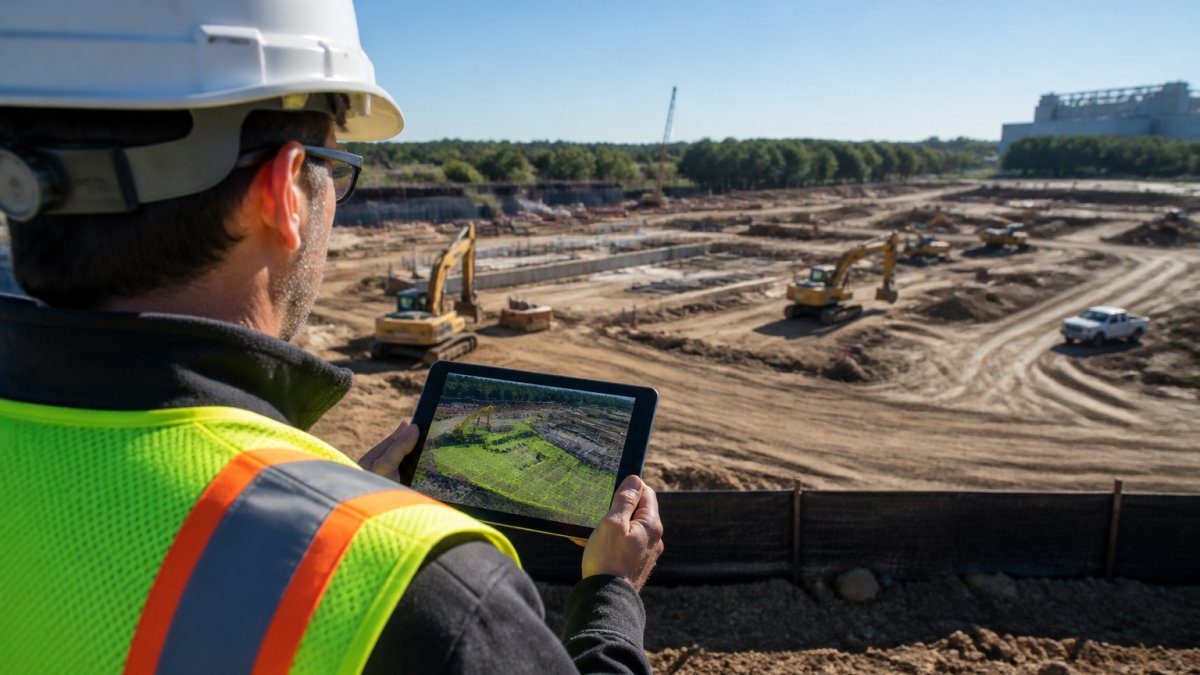
Planning starts with defining your objective, tracking progress, measuring volumes, inspecting assets, or documenting conditions. The objective determines flight altitude, overlap requirements, and ground-control strategy.
Aerial data capture requires FAA Part 107 compliance and site coordination: clear airspace, communication with the site team, and safety protocols.
Deliverable processing converts raw imagery into actionable outputs: orthomosaics (top-down maps), 3D models, volumetric measurements, or timeline comparisons.
The full workflow, planning to final deliverable, depends on site complexity and deliverable type.
How to Choose the Right Drone Software for Your Project
Most selection guides say to consider your use case, tech stack, and team, true but not useful. A better approach: match the tool to your team size, site scale, budget model, and technical skill level. The recommendations below are organized that way.
By team size and technical skill
A small team with no dedicated drone operator should avoid platforms requiring manual flight planning, processing hardware, and ongoing software administration.
A mid-size team with one trained pilot can run an in-house platform. DroneDeploy is the most common fit: automated flight planning reduces the skill needed for consistent data capture, and timeline views make progress tracking straightforward.
A large team with survey or engineering staff can justify Pix4D or Propeller Aero. Pix4D suits flexible photogrammetry and CAD or GIS outputs; Propeller Aero suits earthworks and stockpile measurement.
By site scale and flight frequency
A single site flown monthly is a documentation problem, not a data-processing one, a service provider or a simple platform with automated flight planning suffices. Multiple sites flown weekly is a program, and programs benefit from shared dashboards, consistent flight paths, and project management integration. Very large sites with active earthwork need measurement-grade workflows and ground control, pointing toward Pix4D or Propeller Aero.
By budget model
Subscription platforms make sense when flight frequency is high enough to spread the cost across many projects. Service-based pricing makes sense for occasional flights or teams without the labor to process data. Hardware is a hidden cost: large 3D models need a capable workstation, and cloud processing often carries per-project or per-credit costs. Ask vendors how processing is billed before comparing subscription prices.
By primary deliverable
If the deliverable is a progress record, prioritize timeline views, annotation, and sharing. If it is a measurement, prioritize ground control support, validation documentation, and export formats. If it is a 3D model for design coordination, prioritize reconstruction quality and CAD or BIM export. Matching the tool to the deliverable prevents paying for accuracy you will not use, or accepting visual-grade accuracy where quantities affect payment.
A practical shortlist
For recurring progress tracking with project-management integration, start with DroneDeploy. For DJI-based teams wanting one platform for planning and reconstruction, start with DJI Terra. For photogrammetry and surveying flexibility, start with Pix4D. For earthworks and stockpile measurement, start with Propeller Aero. For expert collection, analysis, and validation without building in-house capability, a service provider delivers the full workflow.
Run a one-site pilot before committing to an annual platform. Fly the same area twice, process both datasets, and compare the outputs against a known measurement. The pilot reveals more about fit than any feature list.
Frequently Asked Questions
What features should construction teams look for in drone software for construction site tracking?
Construction teams should prioritize automated flight planning, week-over-week timeline views for comparing site conditions, integrations with project management platforms like Procore, accurate 3D modeling and orthomosaics, and user-friendly dashboards. Real-time progress documentation, volumetric measurement for stockpiles and earthworks, and mobile access for on-site teams are also critical. The software should support repeatable flights to track changes consistently over time and generate reports that subcontractors and stakeholders can easily understand.
How does drone survey accuracy for earthworks compare to traditional surveying methods?
Drone survey accuracy for earthworks using photogrammetry and LiDAR can achieve centimeter-level precision, matching or exceeding traditional ground surveys in many cases. Drones capture data faster and cover larger areas in a single flight, reducing labor costs and project delays. However, accuracy depends on ground-control points, weather conditions, and software calibration. For mission-critical measurements like grading or stockpile volumes, validation against ground truth points ensures reliability. Drones excel at detecting early errors in grading or material placement that manual surveys might miss.
How often should a construction site be mapped with drone software?
Mapping frequency depends on project phase and risk tolerance. Active construction sites typically benefit from weekly or bi-weekly flights to track progress, verify subcontractor work, and catch errors early. High-stakes phases (grading, foundation, structural framing) may warrant more frequent mapping. Slower phases can stretch to monthly intervals. Automated flight planning in software like DroneDeploy makes frequent mapping practical without excessive labor. Regular intervals create a time-stamped visual record that protects all parties and supports insurance and compliance documentation.
Can drone software integrate with the project management systems we already use?
Many construction drone software platforms integrate with major project management tools. DroneDeploy connects with Procore and Autodesk Construction Cloud, allowing seamless data flow into your existing workflows. Other platforms like Propeller Aero are designed specifically for construction reporting and may offer integrations as well. Before selecting software, confirm that it connects to your current systems to avoid creating isolated data silos. Integration reduces manual data entry, speeds up reporting, and ensures your entire team has access to current site imagery and measurements.